
Wain Wath Force
Wain Wath Force: The Broadest Waterfall in Upper Swaledale
Wain Wath Force will never win a prize for height. The River Swale drops only around a metre and a half here, sliding gently over a wide limestone ledge beneath the pale cliffs of Cotterby Scar. But what it lacks in drama, it makes up for in breadth and setting: the falls stretch across the full width of the river, framed by a long band of dappled white limestone rising on the far bank, with a broad grassy meadow on the near side perfect for a picnic, a paddle, or simply sitting and watching the Swale go by.
It is one of five waterfalls clustered in the short stretch of river around the remote hamlet of Keld, in the Yorkshire Dales National Park — a concentration of falling water that is unmatched anywhere else in the Dales. Both the Coast to Coast Walk and the Pennine Way pass close by, meaning Wain Wath Force is one of the most-walked-past waterfalls in northern England, even if relatively few visitors realise quite how many other falls lie within a short walk of it.
Here is everything you need to plan a visit.
About Wain Wath Force
Wain Wath Force sits on the River Swale around 0.6 miles (1 km) upstream of the hamlet of Keld, at grid reference NY883015, in the heart of the Yorkshire Dales National Park. The drop is modest — around 1.5 metres (5 feet) — but the falls are wide, spreading across the full breadth of the Swale as the river flows beneath the long limestone cliffs of Cotterby Scar on the far bank.
Keld and its immediate surroundings have an unusually rich concentration of waterfalls for such a small area: alongside Wain Wath Force are Kisdon Force, East Gill Force, Catrake Force, and the lesser-known Currack Force, just to the northeast. Together they make this stretch of Upper Swaledale one of the best short waterfall-walking areas in England.
A broad, grassy meadow lies between the road and the river at Wain Wath Force — well used for picnics, sunbathing and, in warm weather, wild swimming in the wide, shallow pools below the falls.
Getting there
By car, from the hamlet of Keld, head north on the B6270 towards Kirkby Stephen. Wain Wath Force is about 0.6 miles west of Keld; you will pass Park Bridge shortly before reaching the falls, which are visible from the road. Free roadside parking is available near a gated entrance to the riverside meadow, though space is limited.
By public transport, options to Keld are limited. The nearest connections are via Kirkby Stephen or Hawes, both some distance away; check the Yorkshire Dales National Park website for any seasonal bus services, and expect to arrange a taxi for the final stretch.
On foot, Wain Wath Force lies directly on the Coast to Coast Walk, which follows the north bank of the Swale here, and is less than a mile from the Pennine Way. From Keld, a level 0.6-mile walk along the riverside path reaches the falls in around 15–20 minutes.
If you're staying further afield, Hawes or Richmond are the nearest towns with a wider range of transport connections.
Compare Transfers & Local Transport in the Yorkshire Dales →
Where does the name come from?
Force comes from the Old Norse foss, meaning waterfall — the same root behind nearly every "Force" in the north of England. Wath is the Anglo-Saxon word for a ford, and Wain likely denotes a cart or wagon — together, "Wain Wath" describes a ford wide and shallow enough for a cart to cross. The river does broaden noticeably just east of the falls, which is consistent with the idea that a crossing point once existed here, connecting the farms and settlements on either side of the Swale.
The walk and the trails
From Keld to Wain Wath Force (around 1.2 miles return, 30–40 minutes, easy): A level, well-marked path follows the River Swale from Keld hamlet to the falls, part of the Coast to Coast Walk. The route passes through lush meadows with views across to Cotterby Scar throughout.
The Yorkshire Dales Waterfalls Walk (around 5 miles, 2–3 hours, easy to moderate): A loop from Keld taking in Wain Wath Force, Currack Force and East Gill Force, with a detour to Crackpot Hall, a ruined farmhouse abandoned after lead-mining subsidence, with panoramic views down Swaledale. This is the fullest way to see the concentration of waterfalls around Keld in a single outing.
For long-distance walkers, both the Coast to Coast Walk (182 miles, Robin Hood's Bay to St Bees) and the Pennine Way (268 miles, Edale to Kirk Yetholm) pass through this immediate area — the Pennine Way crosses the Coast to Coast route at Keld itself, making the hamlet one of the great crossing points of English long-distance walking.
Parking
Free roadside parking is available on the B6270 near the gated entrance to the riverside meadow at Wain Wath Force, though spaces are limited, especially in summer. Park considerately — the road is narrow and needs to remain passable for other traffic.
An alternative is the honesty-box car park at Rukin's Campsite in Keld village, a short walk from the falls, which also has toilet facilities. Check the signs on site for the current charge.
Facilities
There are no facilities at Wain Wath Force itself — no toilets, café or shelter. The riverside meadow is undeveloped, which is much of its charm.
Keld hamlet, around 0.6 miles away, has the Keld Countryside and Heritage Centre and toilet facilities at Rukin's Campsite (small charge). A tearoom operates seasonally in the village — check locally for current opening.
Things to know before you go
Best time to visit. Summer for wild swimming and picnicking on the meadow, when the water is at its most inviting. Spring and autumn are quieter and give beautiful colour on the surrounding fells and along Cotterby Scar. After heavy rain, the wide falls are more dramatic, though the shallow, broad character of the falls means the change is less pronounced than at a taller waterfall.
Wild swimming. The wide, shallow pools below the falls are a popular summer swimming spot. Water levels vary — check for exposed rocks before jumping or diving in, particularly when the river is low. The current can be stronger than it appears after rain.
Dogs. Dogs are welcome but should be kept on leads near the road and around livestock in the surrounding fields.
Accessibility. The roadside parking is close to the falls, but the grassy bank down to the river can be wet, uneven and slippery, making it difficult for wheelchairs or those with limited mobility.
Families. An easy and rewarding spot for families — level access, a wide grassy meadow for picnics, and gentle falls that are much less intimidating than some of the taller Dales waterfalls. Supervise children near the water at all times.
Where to stay
The nearest accommodation is in Keld itself, a tiny hamlet with limited options including Keld Lodge. For a wider choice, Hawes, around 11 miles southwest, is the main market town of upper Wensleydale with a good range of accommodation, shops and cafés.
Find Hotels & Stays in Hawes →
What to pack
A short, easy visit, but the Dales weather and riverside terrain are worth preparing for.
- A pair of waterproof walking boots — the grassy bank to the river can be wet and slippery, particularly after rain.
- A waterproof jacket and warm layers; upper Swaledale is exposed and the weather changes quickly.
- A pair of binoculars — dippers and grey wagtails are regular on this stretch of the Swale, and curlew and lapwing can be seen on the surrounding meadows.
- A travel tripod for long-exposure shots of the broad cascade against Cotterby Scar.
If you're planning swimming, bring a towel and appropriate swimwear; if walking the fuller Keld waterfalls circuit, an OS Explorer OL30 map is worth carrying.
Nearby attractions and making a day of it
Wain Wath Force sits at the centre of the most waterfall-rich stretch of river in the Yorkshire Dales.
| Attraction | Why Visit | Distance |
|---|---|---|
| Currack Force | A quieter, lesser-known waterfall just northeast of Wain Wath Force — a rewarding stop for those exploring the full Keld waterfalls circuit | Adjacent |
| East Gill Force | A two-drop waterfall at the exact point where the Pennine Way meets the Coast to Coast Walk — one of the most-walked waterfall locations in England | ~1 mile |
| Kisdon Force | The most dramatic of Keld's waterfalls, hidden in a wooded gorge on the Swale with a 10-metre drop | ~1.5 miles |
| Keld hamlet | One of the remotest settlements in the Yorkshire Dales, with a heritage centre explaining the valley's Norse and lead-mining history | ~0.6 miles |
| Muker village | A beautiful upper Dales village with a tearoom, a historic church, and the finest wildflower hay meadows in England, at their peak in late May and June | ~4 miles |
For a full Keld waterfalls day, combine Wain Wath Force with Currack Force, East Gill Force and Kisdon Force on the Yorkshire Dales Waterfalls Walk, finishing with tea in Muker.
Browse Yorkshire Dales Tours & Experiences →
Photography tips
Wain Wath Force is best photographed from the designated viewing spot opposite the falls, set back from the road, which frames the full width of the cascade against the pale limestone of Cotterby Scar behind. A wide-angle lens captures the breadth of the falls better than a telephoto, emphasising exactly what makes this waterfall distinctive.
Early morning and late afternoon light brings out the warm tones in the limestone cliffs and the golden hue of the water over the rocks. After rain, the falls run fuller and more textured; a long exposure smooths the water into a silvery sheet across the ledge. Including a swimmer or the surrounding meadow in the frame gives a good sense of scale and the relaxed, sociable character of the spot in summer.
Conclusion
Wain Wath Force does not need to be tall to be memorable. Its width, its setting beneath Cotterby Scar, and its position at the meeting point of two of England's great long-distance paths make it one of the most pleasant stops in the whole of Swaledale. Combine it with the other Keld waterfalls, bring a picnic, and give yourself an afternoon in one of the quietest and most beautiful corners of the Yorkshire Dales.
FAQs
How tall is Wain Wath Force?
Around 1.5 metres (5 feet) — a broad, gentle cascade rather than a tall drop. Its character comes from its width across the full River Swale rather than its height.
Is there a fee to visit Wain Wath Force?
No — the falls are free to visit. Roadside parking nearby is free; the alternative honesty-box car park at Rukin's Campsite in Keld has a small charge (check signs on site).
What is the best time to visit Wain Wath Force?
Summer for wild swimming and picnicking on the riverside meadow. Spring and autumn for quieter visits and good colour on the fells and Cotterby Scar.
Are dogs allowed at Wain Wath Force?
Yes, but keep them on leads near the road and around livestock in the surrounding fields.
Is Wain Wath Force accessible for wheelchairs?
The roadside parking is close to the falls, but the grassy bank down to the river can be wet and uneven, making it difficult for wheelchairs or those with limited mobility.
What are the parking options at Wain Wath Force?
Free roadside parking on the B6270 near the gated entrance, though spaces are limited. The honesty-box car park at Rukin's Campsite in Keld is a short walk away.
Can I swim at Wain Wath Force?
Yes — the wide, shallow pools below the falls are a popular wild swimming spot in summer. Check for exposed rocks before diving in, especially when water levels are low, and take care as the current can be stronger than it looks after rain.
What should I wear when visiting Wain Wath Force?
Sturdy waterproof footwear for the wet, grassy bank, weather-appropriate clothing, and swimwear if you plan to swim.
Is Wain Wath Force on a long-distance path?
Yes — it lies directly on the Coast to Coast Walk (which follows the Swale's north bank here) and is less than a mile from the Pennine Way. Keld, just to the east, is the point where the two routes cross.
What's nearby?
Currack Force (adjacent), East Gill Force (~1 mile), Kisdon Force (~1.5 miles), Keld hamlet (~0.6 miles) and Muker village (~4 miles).
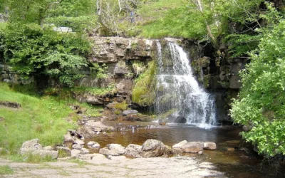
East Gill Force
East Gill Force: Where Two Great Walks Meet There is a particular pleasure in arriving at East Gill Force. You have walked the short path from Keld, crossed the long stone footbridge over the River Swale, and then the path turns and the waterfall is simply there — the...
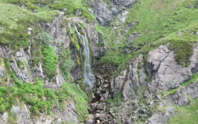
Spout of Garnock
Spout of Garnock: Ayrshire's Highest Waterfall The River Garnock rises on the southern slopes of the Hill of Stake, the highest summit in Clyde Muirshiel Regional Park, and barely has time to become a river before it falls off the edge of the moorland. About a mile...
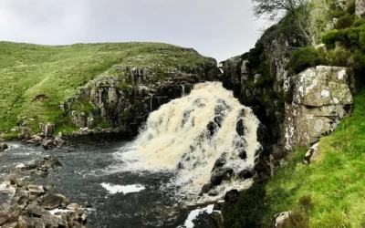
Cauldron Snout
Cauldron Snout: England's Longest Waterfall Most waterfalls announce themselves with a sudden vertical drop. Cauldron Snout does something different: it unrolls. From below, the River Tees is white and relentless for two hundred yards, cascading down the black...
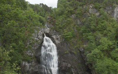
Falls of Foyers
Falls of Foyers: The Smoking Falls of Loch Ness When Robert Burns reached the Falls of Foyers in 1787 and looked down into the gorge, he saw what he described as "the horrid cauldron" — the deep, spray-filled amphitheatre at the base of the lower falls,...
Falls of Bruar
Falls of Bruar: The Waterfall That a Poem Built When Robert Burns visited the Falls of Bruar in September 1787, the gorge was bare moorland. The falls were already beautiful — a series of cascades dropping through a narrow gorge of ancient Highland rock, with two...