
Cotter Force
Cotter Force: Wensleydale's Most Accessible Waterfall
Most waterfall walks in the Yorkshire Dales involve a certain amount of commitment — boggy ground, uneven paths, steep descents, a scramble at the end. Cotter Force is different. A level, compacted stone path runs for 490 metres from the roadside lay-by to a wooden bench with a clear view of the falls, and every metre of that path is suitable for wheelchairs and pushchairs. It is one of the most genuinely accessible waterfalls in the whole of the National Park.
And yet, despite being small — six steps of cascading water, the largest single drop no more than five feet — it is a genuinely beautiful place. The falls widen as they descend, fanning the water out in a pattern that local walkers have long called the "wedding cake falls." The woodland on either side is rich with birdsong. And when J. M. W. Turner came here in July 1816 and sketched the scene for his Yorkshire Sketchbook, he noticed the children peering down from the rocks above — an image of this quiet dale that feels as true today as it did then.
Here is everything you need to plan a visit.
About Cotter Force
Cotter Force sits on Cotterdale Beck, a small tributary of the River Ure, near the mouth of Cotterdale — a secluded side dale off the head of Wensleydale, about two miles west of Hawes. The beck has several smaller falls in its course, but Cotter Force is the largest, comprising six distinct steps, each with its own small cascade, widening from around 13 feet (4 metres) at the top to 43 feet (13 metres) at the base.
Two artists of note have recorded it. Turner made his pencil sketch here in July 1816 during his extensive Yorkshire tour; his note beside the drawing — "Children looking over" — captures the moment local children crept to the edge of the rocks above to watch the strange man with his drawing pad. The Victorian etching artist Richard Samuel Chattock visited in 1864 and produced two works of the falls. Both recorded a place that has changed remarkably little.
The falls are not visible from the road. A short path leads in from the A684, running alongside the beck through woodland and open meadow before the water comes into view. The path was substantially upgraded by the Yorkshire Dales Millennium Trust, giving it a compacted stone surface 110 cm wide with three evenly spaced seating areas — a rare and very welcome combination of natural beauty and genuine accessibility.
Getting there
By car, take the A684 west from Hawes towards Sedbergh. After crossing the River Ure at Holme Heads Bridge — a narrow stone bridge around two miles from the town — you will find a small lay-by on the right-hand side. The path to Cotter Force starts here, clearly signed. The drive through upper Wensleydale is beautiful in its own right, with views of Great Shunner Fell to the north.
By public transport, Hawes is the nearest hub. The Little White Bus (run by Dales Community Enterprises) connects Hawes with Garsdale railway station on the Settle–Carlisle line, and the Wensleydale Flyer (route 156/856) runs from Northallerton on selected days via DalesBus. From Hawes, the lay-by is about two miles west — walkable along the A684 in under an hour (the road has a verge for much of this stretch), or a short taxi ride.
For visitors coming from further afield, Hawes is around 30 minutes from the A1(M) via Bedale and Leyburn, or accessible from the Settle–Carlisle line at Garsdale.
Compare Transfers & Local Transport in the Yorkshire Dales →
Where does the name come from?
Force is the familiar Old Norse term for a waterfall, found throughout the dales of northern England — the same root that gives Hardraw Force, High Force and Aira Force their names. Cotter comes from Cotterdale, the secluded side dale through which the beck flows. The precise etymology of "Cotter" is not fully documented, but the dale name appears in old records and likely derives from an Old Norse or Old English word for a cottage or small enclosure — a memory of the farming communities that have worked this valley for a thousand years.
The walk and the trails
The accessible path to Cotter Force (490m / 1,600ft each way, about 15–20 minutes return) is the main attraction. From the A684 lay-by, cross the small bridge over the beck and follow the signed, level path alongside Cotterdale Beck through the woodland. Three stone benches are spaced along the route. At the end, a wooden bench faces the falls directly — the viewpoint Turner chose in 1816 and still the best position to watch the six cascades fan out across the rock.
The path is suitable for wheelchairs, pushchairs and all-terrain mobility aids. The surface is compacted stone. There are no stiles on the route. It is genuinely one of the most inclusive short walks in the Yorkshire Dales.
For those who want more, Cotter Force is also an excellent starting point for longer routes. A circular walk of around 10 miles takes in Hardraw Force and the Pennine Way to the east, Aysgill Force to the south, and the market town of Hawes — a full waterfall day in the heart of Wensleydale. The path between Cotter Force and Hardraw Force (around 1.5 miles on foot) is a fine short extension on its own.
Parking
There is a small, free lay-by on the A684 near Holme Heads Bridge, around two miles west of Hawes. It holds around six to seven cars. On busy summer weekends and bank holidays it can fill, so arriving early is wise — but this is a quiet, lesser-known site and pressure on the lay-by is rarely as intense as at more prominent Dales attractions.
If the lay-by is full, Hawes has a pay-and-display car park near the Dales Countryside Museum (DL8 3NT), around two miles away. From Hawes, the walk along the A684 to the lay-by and on to Cotter Force can be combined into a pleasant out-and-back of around 5 miles.
There are no toilets at the lay-by or on the path. The nearest public toilets are in Hawes at the National Park Visitor Centre.
Facilities
There are no facilities at Cotter Force itself — no café, no toilets, no shop. It is a quiet, undeveloped site and all the better for it. Come self-sufficient with food, water and waterproofs.
Hawes, two miles east, has everything: cafés, shops, the Wensleydale Creamery visitor centre and café, the Dales Countryside Museum, and public toilets. It is an excellent place to base yourself before or after the visit.
Things to know before you go
Best time to visit. After heavy rain for the most impressive flow, when the six steps become a continuous rush of white water. In dry summer weather, the beck can reduce to a trickle, though the setting — the birdsong, the woodland, the open meadow beside the beck — remains lovely. Spring is particularly fine: the banks fill with wildflowers, and the migrant birds begin to arrive.
Dogs. Dogs are welcome and should be kept on leads around livestock in the surrounding fields.
Accessibility. This is one of the Yorkshire Dales' best accessible waterfalls — compacted stone path 110 cm wide, no stiles, level throughout, three benches en route. Check the Yorkshire Dales National Park "Miles Without Stiles" pages for the most current accessibility information.
Families. A wonderful, short walk for all ages. The very youngest children can be pushed to the viewpoint bench. Keep children close near the beck, which runs fast after rain.
Wildlife. The path beside the beck is excellent for birdwatching: dippers and grey wagtails are regularly seen on the rocks, redstarts appear in the woodland in spring and summer, and lucky visitors sometimes spot a kingfisher flashing upstream. Long-tailed tits are year-round companions along the wooded section.
Where to stay
The natural base is Hawes, the busy market town of upper Wensleydale, two miles east on the A684 — with the widest choice of accommodation in the dale, good road links, and the Wensleydale Creamery as an added draw.
Find Hotels & Stays in Hawes →
What to pack
Even on the short accessible path, a little preparation is worthwhile.
- A pair of waterproof walking boots — the path is well-surfaced but patches near the beck can be muddy after rain.
- A waterproof jacket and warm layers; upper Wensleydale is exposed and the weather changes quickly.
- A pair of binoculars — dippers, grey wagtails, kingfishers and redstarts are all regularly seen on this short walk.
- A travel tripod for long-exposure shots of the cascade in the shaded woodland light.
An OS Explorer OL30 map is worth carrying if you plan to extend to Hardraw Force or walk in from Hawes.
Nearby attractions and making a day of it
Cotter Force sits at the heart of a rich stretch of Wensleydale, with three other waterfalls within easy reach.
| Attraction | Why Visit | Distance |
|---|---|---|
| Hardraw Force | England's highest single-drop waterfall above ground — 30 metres in one unbroken plunge, featured in Robin Hood: Prince of Thieves. A small admission fee applies — check the official website | ~1.5 miles on foot |
| Hawes & Wensleydale Creamery | The capital of upper Wensleydale — market town, cafés, Dales Countryside Museum, and the Wensleydale Creamery visitor centre (home of the cheese made famous by Wallace and Gromit) | ~2 miles |
| Aysgarth Falls | The River Ure over three broad limestone steps — voted one of Britain's favourite walks and a Robin Hood: Prince of Thieves filming location | ~6 miles |
| Semerwater | A peaceful natural lake — one of only two natural lakes in Yorkshire — with a gentle circular walk and wide dale views | ~5 miles |
| Aysgill Force | A quieter, lesser-visited 40-foot waterfall in Duerley Beck, south of Hawes — off the usual tourist trail | ~2 miles |
For a full waterfall day, walk from Hawes to Cotter Force, then continue to Hardraw Force on the Pennine Way, returning via the fields to Hawes — about 10 miles and three waterfalls.
Browse Yorkshire Dales Tours & Experiences →
Photography tips
Cotter Force is a compact, sheltered subject — the woodland frames the falls closely and the light is dappled for most of the day. The wooden bench at the end of the path gives the classic straight-on view of all six cascades together; this is the Turner viewpoint.
For variety, walk alongside the beck on the approach for angled shots of the water in motion against the mossy rock, or use the surrounding trees as a frame. A tripod is useful here — the shaded position means a slow shutter speed works well and smooths the cascading steps into soft, luminous threads. Visit after rain for the fullest flow.
Autumn turns the flanking trees gold and copper, adding colour to a scene that is predominantly green and grey in summer. The early morning light, before the main woodland shadow falls across the falls, is generally the most flattering.
Conclusion
Cotter Force occupies a quiet corner of Wensleydale that most visitors pass through without stopping. It asks nothing strenuous of you — a level five-minute walk from the road, a bench with a view, six steps of cascading water and a woodland full of birds. Turner found it worth sketching in 1816, and it has changed little since. If you are in the upper Dales for the better-known falls, the short detour here will not disappoint.
FAQs
How tall is Cotter Force?
Cotter Force comprises six cascading steps rather than a single drop. The largest individual step is around 5 feet (1.5 metres) high; the falls widen from about 13 feet (4 metres) at the top to 43 feet (13 metres) at the base, giving them the "wedding cake" shape they are known for locally.
Is there a fee to visit Cotter Force?
No — both the falls and the path are completely free. Parking in the A684 lay-by is also free.
What is the best time to visit Cotter Force?
After heavy rain for the strongest flow. Spring is particularly rewarding for wildflowers and bird activity. The falls remain pleasant even in dry spells, though the water level drops.
Are dogs allowed at Cotter Force?
Yes, dogs are welcome. Keep them on leads around the livestock in the surrounding fields.
Is Cotter Force accessible for wheelchairs?
Yes — it is one of the most accessible waterfalls in the Yorkshire Dales. The 490-metre path is compacted stone, 110 cm wide, with no stiles and three benches along the way. It is listed on the Yorkshire Dales National Park "Miles Without Stiles" programme.
What are the parking options at Cotter Force?
A small free lay-by on the A684 near Holme Heads Bridge (around 2 miles west of Hawes) holds about 6–7 cars. If it is full, the pay-and-display car park in Hawes (DL8 3NT) is around 2 miles away.
Can I swim at Cotter Force?
The beck is shallow and rocky, and not suitable for swimming, though paddling is possible at the top of the falls in fine weather — take care on the slippery rock.
What should I wear when visiting Cotter Force?
Sturdy footwear with some waterproofing and a waterproof jacket. The path is well-maintained but can be muddy near the beck in wet weather.
Were any famous artists inspired by Cotter Force?
Yes. J. M. W. Turner sketched Cotter Force in July 1816 as part of his extensive Yorkshire tour, noting "Children looking over" on his drawing — a detail that brings the scene vividly to life. Richard Samuel Chattock, a Victorian etching artist, also produced two works of the falls in 1864.
What's nearby?
Hardraw Force (England's highest single-drop waterfall), Hawes and the Wensleydale Creamery, Aysgarth Falls, Semerwater, and Aysgill Force.
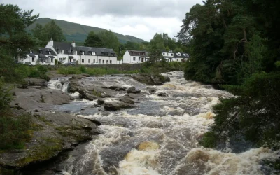
Falls of Dochart
Falls of Dochart: The Waterfall at the Heart of a Village Most waterfalls require a walk to find. The Falls of Dochart require no such effort at all — they run directly through the centre of Killin, beneath the old stone Bridge of Dochart, in full view of the...
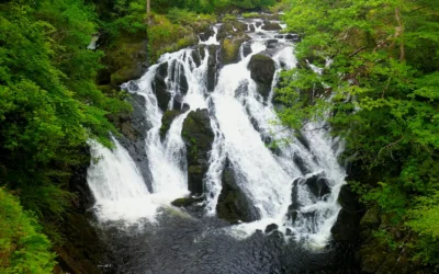
Swallow Falls
Swallow Falls: Wales' Highest Continuous Waterfall The River Llugwy has been performing for visitors at Swallow Falls for well over a century, and it still knows exactly what it is doing. The water tumbles 42 metres through a narrow, tree-lined gorge in a sequence of...
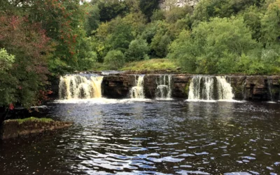
Wain Wath Force
Wain Wath Force: The Broadest Waterfall in Upper Swaledale Wain Wath Force will never win a prize for height. The River Swale drops only around a metre and a half here, sliding gently over a wide limestone ledge beneath the pale cliffs of Cotterby Scar. But what it...
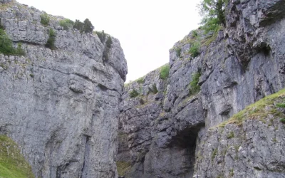
Gordale Scar
Gordale Scar: The Gorge That Stopped Wordsworth in His Tracks There is a moment as you walk the flat, pleasant path from Malham when the gorge closes around you without warning. The sky narrows to a strip above. The walls rear up on either side — overhanging...
Low Force
Low Force: Teesdale's Most Peaceful Waterfall High Force gets the crowds. Low Force gets the quiet. Just a mile and a half downstream from its more famous neighbour, where the River Tees spreads wide across a series of 18-foot cascades over the Whin Sill...