
Falls of Bruar
Falls of Bruar: The Waterfall That a Poem Built
When Robert Burns visited the Falls of Bruar in September 1787, the gorge was bare moorland. The falls were already beautiful — a series of cascades dropping through a narrow gorge of ancient Highland rock, with two dramatic plunge pools and a natural arch formed over ten thousand years of patient erosion. But Burns felt something was missing. He wrote a poem, The Humble Petition of Bruar Water to the Noble Duke of Atholl, in which the river itself pleaded with the landowner, John Murray, 4th Duke of Atholl, for trees. "Would then my noble master please / To grant my highest wishes / He'll shade my banks wi' tow'ring trees / And bonnie spreading bushes."
The Duke did not act in Burns' lifetime. But when Burns died in 1796, the Duke — perhaps moved by the poem as a memorial — began one of the most ambitious landscaping projects in Highland history, eventually planting 120,000 Larch and Scots Pine at Bruar alone, and over 15 million trees across his estates in total. He became known as "Planter John." He also built the two stone bridges over the falls that still frame the views today, and laid out the path that visitors still walk.
The forest planted after Burns' death is no longer quite the same forest: European Larch disease forced felling in 2018, and rhododendrons were cleared. Replanting is underway. The gorge is different, more open than it was. But the falls themselves — the lower falls with the stone bridge arching over the deep blue pool, the upper falls stepping more gently through the surviving Scots pine, the natural arch carved in the rock — those are exactly as Burns found them.
Here is everything you need to plan a visit.
About the Falls of Bruar
The Falls of Bruar are a series of waterfalls on the Bruar Water, a tributary of the River Garry, set in a deep gorge about eight miles north of Pitlochry in Perthshire. They were formed over the last ten thousand years, as the river cut its way through layers of Highland rock — the hard rock resisting, the softer rock yielding — creating the deep pools, outcrops and, in one place, a natural arch that make the gorge so distinctive.
The falls consist of a lower and an upper section. The lower falls are the most dramatic: the Bruar Water plunges into a deep, peat-tinted pool beneath the stone bridge the Duke built, and the water swirls through the natural arch below. The upper falls are gentler, stepping down through surviving woodland in a more serene sequence of cascades. The walk between them is the heart of the visit.
Notable visitors have included Burns (1787), William Wordsworth and his sister Dorothy (1803), J. M. W. Turner, and Queen Victoria (1844), who visited while staying with the Duke of Atholl. The falls have been a tourist attraction for over two and a half centuries.
Getting there
By car, the Falls of Bruar are reached via the House of Bruar complex, directly off the A9 at the junction with the B847/B8079, just west of Blair Atholl. It is one of the most prominently signed turning points on the A9 in Perthshire — look for the brown tourist signs. From Pitlochry, the drive north on the A9 takes around 25–30 minutes. From Perth or Edinburgh, allow around an hour and a half. Speed cameras operate on the A9 approaches.
By public transport, the options are limited but do exist. The 87 bus from Pitlochry and the M91 from Edinburgh both pass the House of Bruar. Blair Atholl also has a railway station on the Inverness line, around two miles from the falls; from there a taxi or a walk via the village reaches the House of Bruar. Check current timetables carefully before relying on public transport in this area.
If you are coming from further afield or prefer not to drive, transfers are available from Pitlochry and Blair Atholl.
Compare Transfers & Local Transport in Highland Perthshire →
Where does the name come from?
Bruar most likely derives from the Gaelic bruaich, meaning "brink" or "bank" — a word that describes the steep-sided gorge of the river well. It is the name of the water, and the falls take their name from the stream. The place has been known as Bruar since long before Burns arrived; the poem did not name the falls, but it fixed them permanently in the Scottish literary imagination.
The walk and the trails
The main Falls of Bruar loop (around 1.5 miles, 30–45 minutes, moderate) starts from the House of Bruar car park. A signed path leads behind the eastern end of the shops to the Bruar Water. The path then follows the west bank upstream on a broad gravel track — easy at first, with the river below to your right — passing under a small viaduct and through surviving woodland to the lower bridge. Here the view is dramatic: the stone arch spans the gorge directly above the main pool, with the falls visible above, the water peat-brown and deep.
From the lower bridge, most visitors cross to the east bank and take the better-maintained path uphill through the woodland to the upper bridge, where a second view of the gorge opens above the upper falls. The path gets steeper and rougher on the upper section; there are unfenced drops near the gorge edge, and the surface is uneven and muddy after rain. From the upper bridge, the path loops back down to the starting point via the lower bridge.
Note: because of the recent Larch felling and replanting, some sections of the path that were once enclosed in deep woodland are now more open. The gorge and the rock architecture remain unchanged.
Parking
Parking is at the House of Bruar car park (PH18 5TW), which is large, free and open whenever the falls are accessible. Check on site for any current arrangements. The car park can fill on busy summer weekends, but the House of Bruar is large enough that spaces are usually available. Toilets and facilities are available inside the House of Bruar building.
Facilities
The House of Bruar is a substantial country shopping complex — food hall, country clothing, gifts and a café/restaurant — and is open seven days a week. Toilets are available inside. The trailhead for the falls is immediately behind the eastern end of the shops.
There are no facilities on the trail itself — no shelter, no toilets and no staffed presence. The walk is short enough that this rarely matters, but come prepared for Highland weather.
Things to know before you go
Best time to visit. After heavy rain for the most impressive cascades — the lower falls in full flow, with the pool deep and the water roaring through the natural arch, is a spectacular sight. Spring and autumn offer the richest colour in the surviving woodland. Winter visits can be extraordinary, particularly when snow coats the gorge walls, but the uneven path becomes genuinely hazardous with ice — use walking poles or crampons in freezing conditions.
Replanting note. The European Larch felling (2018) and rhododendron clearance has altered the canopy above parts of the walk. The falls themselves are unchanged; the gorge walls and bridges are unchanged. Replanting is underway. Check Walkhighlands for current trail condition updates.
Dogs. Dogs are welcome on leads throughout the trail. The unfenced drops near the gorge and the steep upper path make a lead essential.
Accessibility. The lower path to the lower bridge is broad and relatively even — a reasonably mobile visitor can reach the lower falls without great difficulty. The full loop to the upper falls is steep, rough and uneven, and is not suitable for wheelchairs or pushchairs.
Families and safety. The lower path to the lower bridge is excellent for families. The upper section requires care — uneven rock, steep ground, unfenced drops. Keep children close near the gorge edge.
Swimming. The deep pools are cold, peat-stained and subject to strong currents. Swimming is not recommended.
Where to stay
The main base for the Falls of Bruar is Pitlochry, the busy, well-connected market town around eight miles south on the A9 — with the widest range of accommodation, good shops and cafés, a Festival Theatre, and direct rail connections from Perth and Edinburgh.
Find Hotels & Stays in Pitlochry →
What to pack
A short walk, but the gorge can be wet and the upper path is rough.
- A pair of waterproof walking boots with ankle support and good grip — the upper path is steep and uneven, and the rocks near the gorge are permanently damp.
- A waterproof jacket and warm layers; Highland Perthshire weather is changeable year-round.
- A pair of walking poles for the steep upper section and for winter/icy conditions in particular.
- A travel tripod for long-exposure shots of the falls from the stone bridges — the light in the gorge rewards a slow shutter speed.
An OS Explorer OL49 map and a snack are worth adding, particularly for those combining the falls with other walks in the area.
Nearby attractions and making a day of it
The Falls of Bruar sit in an exceptionally rich corner of Highland Perthshire, between the Cairngorms to the north and Pitlochry to the south.
| Attraction | Why Visit | Distance |
|---|---|---|
| Blair Castle | One of Scotland's most visited castles — a white-turreted Highland mansion in Blair Atholl, inhabited and historically significant, with a walled garden and extensive grounds | ~5 miles |
| Pass of Killiecrankie | A spectacular wooded gorge on the River Garry, site of the 1689 Jacobite battle — with NTS visitor centre, woodland walks and one of the most photographed views in Perthshire | ~7 miles south |
| Pitlochry Dam & Fish Ladder | An engineering marvel on the River Tummel — a working salmon ladder where Atlantic salmon can be watched navigating upstream through a glass-sided chamber | ~8 miles south |
| Queen's View, Loch Tummel | A panoramic viewpoint over Loch Tummel named after Queen Victoria's first visit in 1866 — one of Scotland's classic Highland views | ~10 miles |
| House of Bruar | The large country shopping complex immediately at the trailhead — food hall, country clothing, gifts and café, ideal for browsing before or after the walk | At the car park |
For a full Highland Perthshire day, combine the falls in the morning with Blair Castle and then the Pass of Killiecrankie on the way back to Pitlochry.
Browse Highland Perthshire Tours & Experiences →
Photography tips
The lower bridge gives the classic shot: the stone arch framing the deep pool below, with the falls cascading in above and to the right. This is the view Burns described, and the one that has appeared in prints and paintings since the 18th century. A long exposure blurs the water into soft threads while keeping the bridge sharp.
The natural arch below the lower bridge — visible from the side, slightly downstream — gives an unusual perspective that most visitors miss. Walk a short distance below the bridge and look back upstream.
On the upper path, the upper bridge frames the falls from above, with the gorge dropping away below — a view best captured in autumn when the surviving Scots pine add colour. Early morning and overcast conditions both work well in the enclosed gorge.
Conclusion
The Falls of Bruar are among the most historically layered natural sites in Scotland. The gorge would be beautiful without its story — the rock arch, the deep pools, the two stone bridges, the falls themselves. But knowing that Burns stood here and wrote a poem to a river, and that a duke with a cannon blasted seeds across the hillside in response, and that the woodland that grew from that act is now being replaced by the next generation of trees — that knowledge makes the walk genuinely extraordinary.
FAQs
How tall are the Falls of Bruar?
The exact heights of the individual falls are not formally documented. The lower falls make the most dramatic impression, dropping into a deep peat-brown pool beneath the stone bridge; the upper falls are a series of gentler cascades through the remaining woodland.
Is there a fee to visit the Falls of Bruar?
No — the falls and the trail are free to visit. Parking at the House of Bruar is free. Check on site for any current parking arrangements.
What is the best time to visit the Falls of Bruar?
After heavy rain for the fullest and most dramatic flow. Spring and autumn for woodland colour and fewer crowds. Winter can be spectacular but requires care with icy conditions on the upper path.
Are dogs allowed at the Falls of Bruar?
Yes, but keep dogs on leads throughout the trail — the unfenced gorge drops and the steep upper section make a lead essential.
Is the Falls of Bruar walk accessible for wheelchairs?
The lower path to the lower bridge is broad and relatively level, giving reasonable access for those with some mobility. The full loop to the upper falls is steep, rough and uneven, and not suitable for wheelchairs or pushchairs.
What are the parking options at the Falls of Bruar?
The large free car park at the House of Bruar (PH18 5TW) is the only practical option. Check on site for current arrangements. It is usually ample except on the busiest summer days.
Did Robert Burns really write a poem about these falls?
Yes. Burns visited in September 1787 and wrote The Humble Petition of Bruar Water to the Noble Duke of Atholl, addressing the poem to the landowner John Murray, 4th Duke of Atholl, and pleading — in the voice of the river itself — for the banks to be planted with trees. The Duke acted on Burns' wish after the poet's death in 1796, planting 120,000 trees at Bruar and becoming known as "Planter John."
What should I wear when visiting the Falls of Bruar?
Sturdy waterproof boots, a waterproof jacket and warm layers. Walking poles are worthwhile for the upper section and essential in icy winter conditions.
Who else visited the Falls of Bruar?
Beyond Burns, notable visitors include William Wordsworth and his sister Dorothy (1803), J. M. W. Turner, and Queen Victoria, who visited in September 1844 while staying with the Duke of Atholl. The falls have been one of Perthshire's leading tourist attractions for over 250 years.
What's nearby?
Blair Castle (~5 miles), the Pass of Killiecrankie (~7 miles), Pitlochry Dam and Fish Ladder (~8 miles), Queen's View over Loch Tummel (~10 miles), and the House of Bruar shopping complex at the car park.
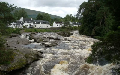
Falls of Dochart
Falls of Dochart: The Waterfall at the Heart of a Village Most waterfalls require a walk to find. The Falls of Dochart require no such effort at all — they run directly through the centre of Killin, beneath the old stone Bridge of Dochart, in full view of the...
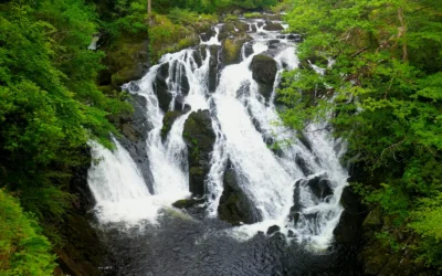
Swallow Falls
Swallow Falls: Wales' Highest Continuous Waterfall The River Llugwy has been performing for visitors at Swallow Falls for well over a century, and it still knows exactly what it is doing. The water tumbles 42 metres through a narrow, tree-lined gorge in a sequence of...
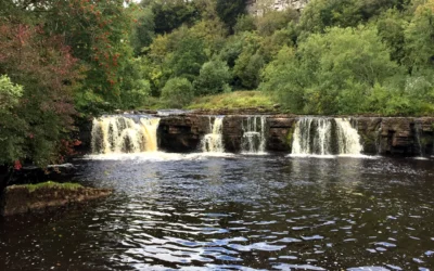
Wain Wath Force
Wain Wath Force: The Broadest Waterfall in Upper Swaledale Wain Wath Force will never win a prize for height. The River Swale drops only around a metre and a half here, sliding gently over a wide limestone ledge beneath the pale cliffs of Cotterby Scar. But what it...
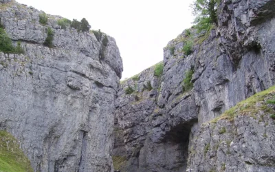
Gordale Scar
Gordale Scar: The Gorge That Stopped Wordsworth in His Tracks There is a moment as you walk the flat, pleasant path from Malham when the gorge closes around you without warning. The sky narrows to a strip above. The walls rear up on either side — overhanging...
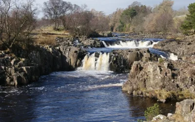
Low Force
Low Force: Teesdale's Most Peaceful Waterfall High Force gets the crowds. Low Force gets the quiet. Just a mile and a half downstream from its more famous neighbour, where the River Tees spreads wide across a series of 18-foot cascades over the Whin Sill...