
Brontë Waterfall
Brontë Waterfall: A Literary Pilgrimage on the Yorkshire Moors
The path from Haworth leads you out of the cobbled streets, past the old church and through kissing gates, and into the wide, windswept moors of West Yorkshire — the same moors that Charlotte, Emily and Anne Brontë walked throughout their lives at the parsonage. It takes about forty-five minutes from the village, and then the path dips into a rocky dell and the sound of water reaches you before the waterfall does.
The Brontë Waterfall is not tall or thundering. It is a series of cascades tumbling over gritstone steps on South Dean Beck, set in a narrow wooded valley where moss covers every stone and a simple bridge crosses the beck below. But it was here that Charlotte Brontë walked on a winter’s day and wrote of it as “a perfect torrent racing over the rocks, white and beautiful”. It was here that the three sisters came for air and stories and space. And standing beside it, that literary connection is unmistakable.
Here is everything you need to plan a visit.
About the Brontë Waterfall
The Brontë Waterfall sits on South Dean Beck, around two and a half miles southwest of Haworth, above the village of Stanbury. It is a modest cascade — not one large plunge, but a series of turbulent steps where the beck tumbles over exposed gritstone in a small, sheltered dell. Its height is not formally recorded; what matters is the setting rather than the statistics.
After heavy rain, Charlotte’s description is entirely justified — the water races, white and fast, over the dark rock. In dry summer spells, it can reduce to little more than a trickle, and the experience changes completely. For the falls at their most eloquent, a visit in autumn, winter or after a good wet spell is the right choice.
Below the waterfall stands the Brontë Bridge, a stone bridge crossing South Dean Beck that has been a landmark on these moors since the sisters’ time. The original was swept away by flash flooding in May 1989 and rebuilt — remarkably, the heavy stone slabs were lifted in by Army helicopter, the only way to reach the remote site quickly enough.
Among the rocks beside the beck you will also find the Brontë Chair — a naturally formed gritstone seat, shaped rather like an armchair, where the sisters are said to have sat to swap stories. The bilingual signs on the path — in English and Japanese — reflect the site’s extraordinary international following; Japanese readers have long been passionate about Emily Brontë’s Wuthering Heights, known in Japan as Arashi ga Oka (“Stormy Hill”), and thousands make the journey here every year.
Getting there
By car, Haworth is around three miles south of Keighley and eight miles west of Bradford. The most useful car park for the waterfall is the free layby on West Lane, right at the edge of Haworth where the moorland path begins — the quickest starting point for the walk. Alternatively, the Museum Car Park (BD22 8DS) off West Lane offers pay-and-display parking close to the Parsonage Museum, a natural start if you’re combining both. Haworth can get very busy at weekends in summer; arriving early is strongly recommended.
By public transport, the Brontë Bus (routes B1, B2 and B3, operated by The Keighley Bus Company) runs regularly from Keighley to Haworth and on to Hebden Bridge — a scenic service in its own right, crossing the moors. From Keighley, trains connect from Leeds, Bradford and further afield. From the Keighley and Worth Valley Railway — a heritage steam line — you can travel to Haworth station at weekends and in summer; it is one of the most atmospheric ways to arrive in Brontë Country.
If you’re coming from further afield, transfers are easily arranged from Bradford, Leeds or Keighley.
Compare Transfers & Local Transport in West Yorkshire →
Where does the name come from?
The waterfall has no ancient Norse name or legendary etymology. It takes its name simply from its most famous visitors — Charlotte, Emily and Anne Brontë, who walked out from their parsonage home in Haworth and came here regularly throughout their lives. The sisters lived at the parsonage from 1820, when their father Patrick Brontë became minister of the parish, until their deaths — Charlotte the last to die, in 1855.
For the sisters, the moors were not a background but a living part of their imagination. Emily in particular found the open moorland essential, and the landscapes around Haworth — the exposed gritstone ridges, the sweeping heather, the wild weather — are woven through Wuthering Heights (1847) and Jane Eyre (1847) in ways both obvious and subtle. The waterfall, the bridge, the open fell above: these were not just walks, they were working visits.
The walk and the trails
The most direct approach is from the West Lane layby at the edge of Haworth, where the moorland path begins. From here, the waterfall is around 1.5 miles away — a walk of about twenty-five minutes on a clear, well-marked path across open moor. The route descends into the beck valley at the end, with a short steepish section to the bridge and falls.
From Haworth village centre (church steps on Main Street), the walk is around 2.5 miles each way, taking about forty-five minutes. The path follows the Brontë Way — well signposted — through fields and over the moorland edge.
The most rewarding option for most visitors is the circular route (around 6 miles, 2.5–3 hours, moderate):
From Haworth, descend via Penistone Hill Country Park toward Lower Laithe Reservoir, pass through the village of Stanbury, and then follow the signed path up to the waterfall. From the falls, the path continues up across open moorland to Top Withens — around a mile further, and forty-five minutes’ walk. Top Withens is a desolate, roofless stone ruin on the moor.
A plaque placed here by the Brontë Society in 1964 states honestly that there is no direct link between this farmhouse and the novel Wuthering Heights, but notes that the moorland setting may have been in Emily’s mind when she chose a location. The return follows the Pennine Way — Britain’s first national trail — back past Lower Laithe Reservoir to Haworth.
Parking
The West Lane layby on the edge of Haworth (at the top of West Lane, near Penistone Hill) is free and puts you right at the start of the moorland path — the best option for the waterfall walk. Spaces are limited; arrive early on weekends.
The Museum Car Park (BD22 8DS) off West Lane, run by Bradford Council, is pay-and-display and has public toilets nearby. It is the most central option if you want to explore Haworth before heading to the falls. Check the current charges locally or on the Bradford Council website.
Facilities
There are no facilities on the moor or at the waterfall — no toilets, no café, no shelter. The walk is remote, and once you leave Haworth you are entirely self-sufficient until you return.
Haworth village has a good range of cafés and tearooms on Main Street, and the Brontë Parsonage Museum has a small shop and information. Stock up on food, water and waterproofs before you head out; the weather on these moors can turn quickly.
Things to know before you go
Best time to visit. After heavy rain for the fullest flow — Charlotte’s “perfect torrent” is reserved for wet weather; in summer dry spells the beck can be almost entirely still. Autumn and winter visits often give the most atmospheric experience, with the full sweep of the moorland visible under wide, grey West Yorkshire skies. Spring brings the first heather colour and longer daylight.
Dogs. Dogs are welcome on the moors and should be kept on leads around livestock and ground-nesting birds, which breed on the open moorland in spring and early summer.
Accessibility. The moorland paths are rocky, uneven and boggy in places, and not suitable for wheelchairs or pushchairs. The final descent to the bridge and falls is particularly rough.
Families and safety. Children who are comfortable walking 3–5 miles on uneven moorland will enjoy the full walk. Keep them close near the beck, which runs fast and cold after rain, and on the open moorland edge.
Swimming. The beck is too shallow and rocky for swimming.
Navigation. The paths are well signed (English and Japanese), but carrying an OS Explorer OL21 (South Pennines) map is always wise on open moorland.
Where to stay
The natural base for this walk is Haworth itself — a village with a character all its own, steep cobbled main street, independent shops and tearooms, and the Parsonage Museum on the doorstep. There are hotels, guesthouses and B&Bs in and around the village, as well as options in nearby Keighley and Bradford.
Find Hotels & Stays in Haworth →
What to pack
The moors demand respect for the weather. Pack as you would for a full Pennines day out, even on a short walk.
- A pair of waterproof walking boots with good ankle support — the path is rocky and boggy in equal measure, especially after rain.
- A waterproof jacket and warm layers; West Yorkshire moorland weather is famously changeable and often cold.
- A pair of binoculars — the moors are home to peregrine falcons, curlews, merlins and golden plovers, all visible from the open path.
- A travel tripod for long-exposure shots of the cascade and the atmospheric moorland light.
An OS Explorer OL21 map, plenty of water and food, and a full charge on your phone (signal is patchy on the open moor) are all worth adding.
Nearby attractions and making a day of it
Haworth and Brontë Country are genuinely rich — this is not just a waterfall walk but an immersion in one of the most important literary landscapes in England.
| Attraction | Why Visit | Distance |
|---|---|---|
| Brontë Parsonage Museum | The Brontë family home, now a museum, where Charlotte, Emily and Anne wrote their novels — essential for any visitor to Brontë Country | ~2.5 miles (Haworth) |
| Top Withens | A roofless moorland ruin on the Pennine Way, associated in atmosphere if not in fact with Wuthering Heights — bleak, beautiful and unmissable | ~1 mile from waterfall |
| Haworth village | The steep cobbled main street, St Michael and All Angels’ Church (where the Brontës worshipped), and the heritage steam railway station | ~2.5 miles |
| Keighley & Worth Valley Railway | A heritage steam railway threading through the Worth Valley, stopping at Haworth — one of the most atmospheric ways to arrive in Brontë Country | From Haworth station |
| Ponden Hall | A 17th-century moorland farmhouse believed to have inspired Thrushcross Grange in Wuthering Heights — on the Brontë Way | ~3 miles |
For a full day, arrive by Brontë Bus or the heritage railway, explore Haworth village and the Parsonage Museum, then walk out to the waterfall and continue to Top Withens.
Browse West Yorkshire & Brontë Country Tours →
Photography tips
The Brontë Waterfall rewards patience and the right conditions. After rain, the cascade fills the rocky dell with motion and sound — a long exposure on a tripod turns the rushing water into the silky white threads Charlotte described. The Brontë Chair rock makes a natural foreground for a wider shot that includes the beck and bridge.
The Brontë Bridge itself, seen from slightly above on the path, frames the water beautifully with the moorland rising behind it. Overcast light flatters the dark gritstone and rich green moss far better than direct sunshine, which can be harsh on wet rock.
The wider moorland is at its most photogenic in late summer and early autumn, when the heather colours the open fell in purple and the light turns golden in the late afternoon.
Conclusion
The Brontë Waterfall is not a record-breaker and it never pretends to be. Its power is entirely different: this is the specific place where three of England’s greatest writers walked, thought and talked, and the moors around it have barely changed since their time. Visit after the rain, walk the full circular to Top Withens, and you will understand what Haworth gave the Brontës — and what it still offers everyone who makes the journey.
FAQs
How tall is the Brontë Waterfall?
The exact height is not formally documented — it is a series of cascades over gritstone steps rather than a single measured drop. Its appeal lies in its literary and atmospheric setting rather than its size.
Is there a fee to visit the Brontë Waterfall?
The waterfall and all the moorland paths are free to access. Parking in Haworth is pay-and-display at the Museum Car Park; the West Lane layby at the moorland edge is free.
What is the best time to visit the Brontë Waterfall?
After heavy rain for the fullest flow, as Charlotte described. Autumn and winter give the most atmospheric moorland light. Spring brings ground-nesting birds and the first heather colour.
Are dogs allowed at the Brontë Waterfall?
Yes. Keep dogs on leads around livestock and ground-nesting birds, which breed on the open moorland in spring.
Is the Brontë Waterfall accessible for wheelchairs?
No. The moorland paths are rocky and uneven, and the descent to the bridge and falls is particularly rough. It is not suitable for wheelchairs or pushchairs.
What are the parking options for the Brontë Waterfall?
The free layby on West Lane at the edge of Haworth is the best option for the waterfall walk. The pay-and-display Museum Car Park (BD22 8DS) off West Lane is the main alternative. Both can fill quickly on summer weekends.
Can I swim at the Brontë Waterfall?
No — the beck is too shallow and rocky for swimming.
What should I wear when visiting the Brontë Waterfall?
Sturdy waterproof walking boots and a waterproof jacket with warm layers. The moorland weather is unpredictable and the path is boggy after rain.
Was the Brontë Bridge always there?
A stone bridge has stood here since the Brontës’ time, but the current structure is a replacement. The original was swept away by flash flooding in May 1989 and rebuilt using heavy stone slabs flown in by Army helicopter.
What’s nearby?
The Brontë Parsonage Museum in Haworth, Top Withens on the open moor, the Keighley and Worth Valley Railway, Haworth village, and Ponden Hall (believed to have inspired Thrushcross Grange).
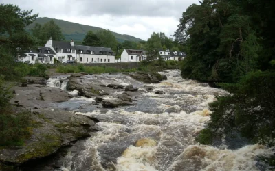
Falls of Dochart
Falls of Dochart: The Waterfall at the Heart of a Village Most waterfalls require a walk to find. The Falls of Dochart require no such effort at all — they run directly through the centre of Killin, beneath the old stone Bridge of Dochart, in full view of the...
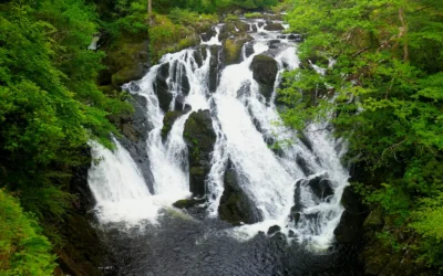
Swallow Falls
Swallow Falls: Wales' Highest Continuous Waterfall The River Llugwy has been performing for visitors at Swallow Falls for well over a century, and it still knows exactly what it is doing. The water tumbles 42 metres through a narrow, tree-lined gorge in a sequence of...
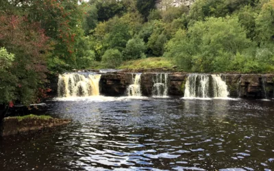
Wain Wath Force
Wain Wath Force: The Broadest Waterfall in Upper Swaledale Wain Wath Force will never win a prize for height. The River Swale drops only around a metre and a half here, sliding gently over a wide limestone ledge beneath the pale cliffs of Cotterby Scar. But what it...
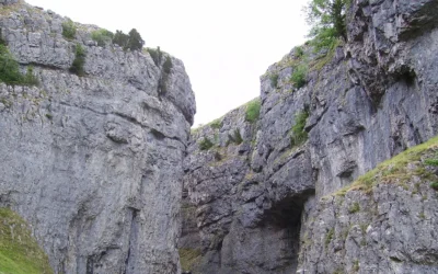
Gordale Scar
Gordale Scar: The Gorge That Stopped Wordsworth in His Tracks There is a moment as you walk the flat, pleasant path from Malham when the gorge closes around you without warning. The sky narrows to a strip above. The walls rear up on either side — overhanging...
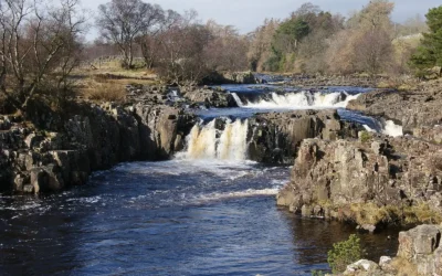
Low Force
Low Force: Teesdale's Most Peaceful Waterfall High Force gets the crowds. Low Force gets the quiet. Just a mile and a half downstream from its more famous neighbour, where the River Tees spreads wide across a series of 18-foot cascades over the Whin Sill...