
Swallow Falls
Swallow Falls: Wales’ Highest Continuous Waterfall
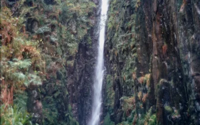
The River Llugwy has been performing for visitors at Swallow Falls for well over a century, and it still knows exactly what it is doing. The water tumbles 42 metres through a narrow, tree-lined gorge in a sequence of tiers, splitting and rejoining around a prominent central rock in a pattern that early visitors thought resembled a swallow’s forked tail. It remains the highest continuous waterfall in Wales, and one of the most photographed natural landmarks in the whole of Snowdonia — locally known these days as Eryri.
The falls have been famous since the Victorian era, when Betws-y-Coed grew into one of Britain’s earliest artists’ colonies and painters flocked to capture the Llugwy’s dramatic gorge. More recently, in 2017, film crews arrived for a rather different reason: a scene for Wonder Woman 1984 was shot here, with the young Diana running through this same landscape. The falls have not needed to change to keep earning their fame.
Here is everything you need to plan a visit.
About Swallow Falls
Swallow Falls (Welsh: Rhaeadr y Wennol, “the waterfall of the swallow,” or Rhaeadr Ewynnol, “the foaming waterfall”) is a multi-tiered waterfall on the River Llugwy in Conwy County Borough, within Eryri (Snowdonia) National Park. At 42 metres (138 feet), it is generally recognised as the highest continuous waterfall in Wales — falling in a connected sequence of drops rather than a single sheer plunge.
The Welsh name Rhaeadr y Wennol is the older and more descriptive of the two: a prominent rock splits the flow of the river into two channels that, from the right angle, do resemble the forked tail of a swallow.
The alternative name, Rhaeadr Ewynnol, was coined later — towards the end of the 18th century — to describe the frothing, foaming character of the water, and some scholars suggest it was also intended to give the falls a distinctly Welsh name of their own, rather than a translation of the increasingly popular English name “Swallow Falls.” A popular modern explanation holds that “Swallow Falls” arose from English visitors mishearing “ewynnol” as “y wennol” — an appealing story, even if the full picture is a little more complicated.
The falls sit within Gwydir Forest, a mixed woodland of beech, conifer and birch that has grown up around the gorge since Victorian times. In 1913, the 2nd Lord Ancaster, then the landowner, gifted the falls to the local council of Betws-y-Coed, which began charging visitors to view them — the proceeds went towards paying off a substantial debt incurred installing water and electricity to the village.
Once the debt was cleared, the parish retained the income for decades, reportedly giving Betws-y-Coed some of the lowest local rates in the country.
Getting there
By car, from Betws-y-Coed drive west on the A5 for around 2.5 miles (4 km) until you reach a small parking area on the right, opposite the Swallow Falls Hotel. The drive is direct and well-signed, but the roadside parking is very limited, so early arrival is worthwhile in peak season.
By bus, services running between Betws-y-Coed and Capel Curig stop near the Swallow Falls Hotel, directly opposite the falls’ entrance — a journey of around five minutes from the Pont-y-Pair bridge in the village centre. Check current timetables locally, as services can be limited outside peak season.
By foot, the falls can also be reached via the Swallow Falls Trail through Gwydir Forest, starting from the Ty’n Llwyn car park — a longer, more immersive route entirely free of charge and separate from the paid viewing platform. Walking from Betws-y-Coed village along the River Llugwy is also possible and takes around an hour each way.
If you’re staying further afield, Betws-y-Coed is the natural hub for transport connections across Eryri.
Compare Transfers & Local Transport in Snowdonia →
Where does the name come from?
Rhaeadr y Wennol — “the waterfall of the swallow” — describes the visual effect of the river splitting around a central rock into two channels resembling a bird’s forked tail. Rhaeadr Ewynnol — “the foaming waterfall” — is a later Welsh name emphasising the frothy, turbulent character of the falls, first recorded towards the end of the 18th century.
The commonly told story that the English name “Swallow Falls” arose purely from a mishearing of “ewynnol” is a simplification of a more layered linguistic history, but it captures something true: the Welsh and English names sound remarkably alike, and visitors for over two centuries have delighted in the coincidence.
The walk and the trails
The Short Viewpoint Walk (around 100 metres, 15–20 minutes, easy): From the parking area opposite the Swallow Falls Hotel, a paid turnstile gives access to a concrete path leading to two or three viewpoints. The upper viewpoints are accessible for most visitors; a set of steps leads down to a closer, lower viewpoint where the spray from the falls can be felt directly. This is the classic, quick way to see the falls.
The Swallow Falls Walk (around 2.25 miles / 3.6 km circular, up to 2.5 hours, strenuous): Starting from the Ty’n Llwyn car park in Gwydir Forest, this free circular route descends through dense woodland to a viewpoint over the falls, with a bench for resting, before climbing back up through trees and rocky outcrops to a second viewpoint with views of Moel Siabod and, on clear days, the Snowdon Horseshoe. The path is waymarked but genuinely rough in places — steep sections, tree roots, mud and uneven ground make sturdy footwear essential.
For a more dramatic (though narrower and more exposed) approach, a path along the northern bank of the Llugwy gives a more atmospheric view of the falls than the main southern viewpoints, though it demands sure footing on a rougher trail.
Parking
A small parking area on the A5, opposite the Swallow Falls Hotel, holds around 10 cars and is free — though very limited, especially in peak season. Alternatively, the Ty’n Llwyn car park in Gwydir Forest offers more space along with picnic facilities and wheelchair-accessible tables, serving as the starting point for the longer Swallow Falls Walk. Limited roadside parking also exists near Betws-y-Coed itself for those who prefer to walk the full distance.
Facilities
The immediate falls area has minimal facilities — a couple of benches near the viewpoints, and no toilets or refreshment kiosks at the entrance itself. The Ty’n Llwyn car park does have wheelchair-accessible picnic tables.
For refreshments, the Ty Hyll (Ugly House) tearoom lies a short walk (around 10 minutes) further along the north bank path, or a few minutes’ drive along the A5 — a charming stone cottage with a garden, well worth combining with a visit to the falls. Betws-y-Coed village, around 2.5 miles east, has the fullest range of cafés, shops and toilets.
Things to know before you go
Best time to visit. After heavy rain for the most dramatic and powerful flow — many long-time visitors note that a November or March flood shows the falls at their absolute best. Summer months, while pleasant, can see reduced flow and more obscuring greenery around the falls. Spring and autumn generally offer the best combination of good water levels and manageable crowds.
Access fee. Access to the main viewing platform on the south bank is via a turnstile with a small entry charge; check current pricing on site. The alternative Swallow Falls Trail through Gwydir Forest, starting at Ty’n Llwyn, is free of charge.
Dogs. Dogs are welcome but should be kept on a lead given the fast-flowing river and the proximity of the paths to steep drops.
Accessibility. The upper viewpoints on the main paid path are manageable for most visitors, though the lower viewpoints involve steps. The Ty’n Llwyn car park has wheelchair-accessible picnic tables, but the longer Swallow Falls Walk is genuinely strenuous and unsuitable for those with mobility difficulties.
Families and safety. The short viewpoint walk suits families well. The longer Swallow Falls Walk, with its steep, rough terrain, is better suited to older children and confident walkers. Paths near the falls can be slippery when wet.
Swimming. Not permitted — the river along the main viewing section is fenced off for safety, as the steep drop to the water and slippery rocks make it genuinely hazardous.
Where to stay
The natural base for exploring Swallow Falls and the surrounding area is Betws-y-Coed, the Victorian-era gateway village to Eryri National Park, around 2.5 miles east — with a wide choice of accommodation, cafés, shops and railway connections via the Conwy Valley line.
Find Hotels & Stays in Betws-y-Coed →
What to pack
The short viewpoint walk needs little, but the longer Swallow Falls Walk through Gwydir Forest is a genuine hike.
- A pair of waterproof walking boots — essential for the Swallow Falls Walk’s steep, rooty, often muddy terrain, and useful even for the short viewpoint path in wet weather.
- A waterproof jacket and warm layers; Snowdonia’s weather is famously changeable, and spray from the falls adds to the dampness near the viewpoints.
- A pair of binoculars for the distant views of Moel Siabod and, on clear days, the Snowdon Horseshoe from the upper viewpoint of the circular walk.
- A travel tripod for long-exposure shots of the falls, particularly useful in the shaded gorge and for capturing the water’s motion.
An OS Explorer OL17 map is worth carrying for the Gwydir Forest routes.
Nearby attractions and making a day of it
Betws-y-Coed and the surrounding Gwydir Forest area offer a rich concentration of attractions within a short distance of Swallow Falls.
| Attraction | Why Visit | Distance |
|---|---|---|
| Ty Hyll (The Ugly House) | A characterful stone cottage of mysterious origin, now a tearoom with a peaceful garden — reached by a short walk along the Llugwy or a few minutes’ drive | ~0.5 miles |
| Gwydir Forest Park | A vast, varied forest of lakes, old mining trails and waymarked walks surrounding Betws-y-Coed — excellent for longer hikes and cycling | Adjacent |
| Fairy Glen | A narrow, atmospheric gorge on the River Conwy with tumbling rapids — one of the most photographed beauty spots in the area | ~2 miles from Betws-y-Coed |
| Conwy Valley Railway Museum | A small railway museum with a rideable miniature steam train, popular with families, near Betws-y-Coed station | ~2 miles |
| St Michael’s Old Church | A 14th-century church, the oldest building in Betws-y-Coed, restored and open to visitors | ~2.5 miles |
For a full day, combine the Swallow Falls Walk with a stop at Ty Hyll for tea, and finish in Betws-y-Coed exploring the village, the railway museum and St Michael’s Old Church.
Browse Snowdonia Tours & Experiences →
Photography tips
The upper viewpoint on the main paid path gives the classic view — the full sequence of tiers visible together, with the central splitting rock clearly framing the “swallow’s tail” effect. The lower viewpoint, reached by steps, brings you close enough to feel the spray, ideal for more intimate, textured shots of the cascading water.
A tripod is genuinely useful here: the gorge is shaded for much of the day, and a slow shutter speed renders the falling water as soft, silky threads against the dark rock. Overcast light generally works better than direct sun, which creates harsh contrast in the enclosed gorge. Include the surrounding beech, conifer and birch trees for depth, or, from the higher viewpoint on the circular walk, frame the falls with Moel Siabod in the background on a clear day.
Conclusion
Swallow Falls has survived more than a century of postcards, paintings and, more recently, a superhero film crew, without losing any of its appeal. The gorge, the split-rock cascade and the surrounding Gwydir Forest remain exactly what drew the first Victorian tourists here — a dramatic, accessible slice of Snowdonia scenery just a few minutes from Betws-y-Coed. Come after rain if you can, and take the time to walk beyond the turnstile into the wider forest that surrounds it.
FAQs
How tall is Swallow Falls?
Swallow Falls is 42 metres (138 feet) tall, generally recognised as the highest continuous waterfall in Wales — falling in a connected series of tiers rather than a single sheer drop.
Is there a fee to visit Swallow Falls?
Access to the main viewing platform via the turnstile involves a small entry charge; check current pricing on site. The alternative Swallow Falls Trail through Gwydir Forest, from the Ty’n Llwyn car park, is free.
What is the best time to visit Swallow Falls?
After heavy rain for the most powerful flow — some of the most dramatic accounts describe the falls after a November or March flood. Spring and autumn generally combine good water levels with fewer crowds.
Are dogs allowed at Swallow Falls?
Yes, but keep them on a lead due to the fast-flowing river and proximity to steep drops.
Is Swallow Falls accessible for wheelchairs?
The upper viewpoints on the main path are manageable for most visitors, though the lower viewpoint involves steps. The Ty’n Llwyn car park has wheelchair-accessible picnic tables.
What are the parking options at Swallow Falls?
A small free parking area on the A5, opposite the Swallow Falls Hotel, holds around 10 cars but fills quickly. The Ty’n Llwyn car park in Gwydir Forest offers more space and is the starting point for the longer circular walk.
Can I swim at Swallow Falls?
No — the river is fenced off along the main viewing area for safety, as the steep drop and slippery rocks make swimming genuinely hazardous.
What should I wear when visiting Swallow Falls?
Sturdy shoes for the uneven, potentially muddy paths, and waterproof clothing, as Snowdonia’s weather can change quickly.
Was Swallow Falls in a film?
Yes — in 2017, film crews used Swallow Falls as a filming location for scenes in Wonder Woman 1984, featuring a young Diana running through the landscape.
What’s nearby?
Ty Hyll (The Ugly House) tearoom (~0.5 miles), Gwydir Forest Park (adjacent), Fairy Glen (~2 miles from Betws-y-Coed), the Conwy Valley Railway Museum (~2 miles) and St Michael’s Old Church (~2.5 miles).
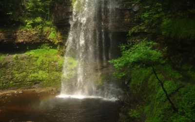
Henrhyd Falls
Henrhyd Falls: South Wales' Tallest Waterfall — and the Batcave The path descends steeply from the car park through sessile oak and ash woodland, and the sound of the water grows before the falls are visible. Then the gorge opens, and Henrhyd Falls drops the full...
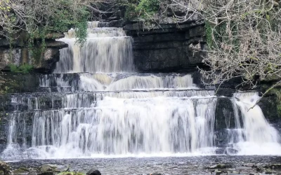
Cotter Force
Cotter Force: Wensleydale's Most Accessible Waterfall Most waterfall walks in the Yorkshire Dales involve a certain amount of commitment — boggy ground, uneven paths, steep descents, a scramble at the end. Cotter Force is different. A level, compacted stone path...
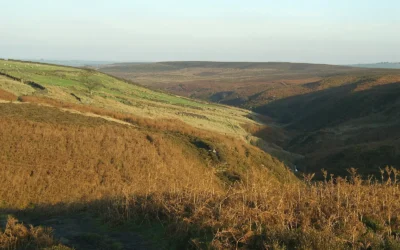
Brontë Waterfall
Brontë Waterfall: A Literary Pilgrimage on the Yorkshire Moors The path from Haworth leads you out of the cobbled streets, past the old church and through kissing gates, and into the wide, windswept moors of West Yorkshire — the same moors that Charlotte, Emily and...
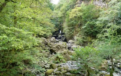
Lodore Falls
Lodore Falls: The Cascade That Inspired a Poem Stand beside Lodore Falls after heavy rain and you begin to understand why Robert Southey, the Poet Laureate who lived at Greta Hall just up the road in Keswick, reached for so many words at once. Dashing and flashing and...
Scale Force
Scale Force: The Lake District's Highest Waterfall You hear the roar before you see it. Then the gorge opens, the trees close in from above, and a single white ribbon of water drops 120 feet in one clean plunge before gathering itself again and falling further...