
Spout of Garnock
Spout of Garnock: Ayrshire’s Highest Waterfall
The River Garnock rises on the southern slopes of the Hill of Stake, the highest summit in Clyde Muirshiel Regional Park, and barely has time to become a river before it falls off the edge of the moorland. About a mile and a half from its source, the young Garnock tips into a gorge and drops around seventy feet in a single cascade — the Spout of Garnock, Ayrshire’s highest waterfall, hidden in the open hills above Kilbirnie.
Getting there takes effort. The walk from Kilbirnie is around eight miles each way, across open moorland with wide views over North Ayrshire and the Firth of Clyde. There are no facilities on the route, few other walkers, and no signposted car park at the falls themselves. What there is, at the end, is a dramatic gorge, the sound of water amplified by the enclosed cliffs, and the particular satisfaction of a waterfall that rewards those willing to earn it.
Here is everything you need to plan a visit.
About the Spout of Garnock
The Spout of Garnock is a waterfall on the upper River Garnock, located within the Clyde Muirshiel Regional Park on the border of North Ayrshire and Renfrewshire. At approximately 60–70 feet (18–21 metres) high, it is the highest waterfall in Ayrshire. The falls drop into a gorge that the young Garnock then carves through for several miles before emerging into the more populated Garnock Valley below.
The waterfall’s location — close to the river’s source at 1.5 miles downstream — led to the long-held but incorrect belief that it marked the actual origin of the Garnock. The true source lies further up the southern slopes of the Hill of Stake (522 metres), the highest point in the Regional Park.
A nearby second waterfall, the Murchan Spout, lies on an adjacent burn to the east — similar in character and often paired with the Spout of Garnock by those exploring the moorland above Kilbirnie. Together they make a compelling reason to venture into this remote, undervisited corner of west-central Scotland.
The moorland setting is part of the appeal. The plateau above Kilbirnie offers wide-open views: on clear days, the Firth of Clyde, Arran and, to the south, much of Ayrshire are visible. The park is also significant for upland birds, including hen harriers, short-eared owls and golden plover.
Getting there
By car, the standard starting point is the Milton Road car park in Kilbirnie — the base used by the Clyde Muirshiel Ranger Service for its guided walks to the falls. From there, the walk to the Spout of Garnock is around eight miles each way through the moorland above town. Kilbirnie is approximately five minutes from the A737, which connects to Glasgow (around 20 miles) and the A78 Ayrshire coast road.
Some walkers use limited rough parking near Holehouse Farm or a quarry further up the access track, if suitable for their vehicle — this shortens the walk by around two miles each way. The upper track is unmetalled; a standard car can usually reach the farm, but take care in wet weather.
By public transport, Glengarnock railway station is the closest rail point — on the Ayrshire line from Glasgow Central (around 30 minutes). From Glengarnock station, Kilbirnie is a short walk or taxi ride, from where the trail to the falls begins. Buses also serve Kilbirnie from Irvine and Paisley.
If you’re arriving from Glasgow or further afield, the train to Glengarnock and a walk to the Milton Road trailhead is the most practical car-free approach.
Compare Transfers & Local Transport in Ayrshire →
Where does the name come from?
Spout is a straightforward and widely used Scots word for a spouting or jetting waterfall — the same term appears elsewhere in Scottish waterfall names, including the Spout of Bruar. Garnock comes from the Scottish Gaelic Gairneag (also written Abhainn Ghairneig) — the traditional name of the river, possibly relating to the rough or rocky nature of the upper valley, though the precise derivation has not been conclusively established. The name is ancient; the Garnock has been known by some form of this name since at least the medieval period.
The walk and the trails
The main trail from Milton Road car park, Kilbirnie (approximately 8 miles each way, 4–5 hours return, moderately strenuous) starts at the edge of town and heads northwest into the moorland above. The path passes through farmland and rough grazing, climbing steadily with increasingly wide views over the Garnock Valley. The route is largely on tracks and open ground; carry an OS Explorer 341 map and have navigation capability, as signage is limited on the upper moor.
The approach is rewarding even before the waterfall: the Hill of Stake and the surrounding moorland are excellent for upland birds, and on a clear day the views extend to Goatfell on Arran. The falls are heard before they are seen.
The viewpoint above the Spout is the primary vantage point, with the full drop visible into the gorge below. A descent to the base is possible, but requires care — the sides of the gorge are steep and the rock becomes slippery near the water.
Guided walks are organised by the Clyde Muirshiel Ranger Service, typically starting from Kilbirnie and covering around 14 km over 5–6 hours. These are a recommended option for those unfamiliar with the terrain or who prefer structured navigation. Check the Clyde Muirshiel Regional Park website for current guided walk dates and booking.
A shorter starting option uses the upper access track to the quarry (roughly two miles closer to the falls), suitable for capable off-road vehicles or those on foot from a different starting point.
Parking
The most reliable starting point is the Milton Road car park in Kilbirnie (KA25), which is free. From here, the walk is around eight miles each way to the falls.
Limited rough parking exists further up the access track towards Holehouse Farm and the quarry beyond — this suits fit walkers wanting a shorter route and those with suitable vehicles. No facilities exist at any parking point.
For those using the Muirshiel Visitor Centre at Lochwinnoch (Calder Glen Road, PA12 4LB) as an alternative starting point, the walk to the Spout of Garnock is longer — approximately 10 km via the Hill of Stake — and offers a fine high-level approach for experienced hillwalkers.
Facilities
There are no facilities anywhere on the trail — no toilets, café or shelter between Kilbirnie and the falls. Come fully self-sufficient: food, water, waterproofs and appropriate navigation equipment. The walk is remote; tell someone your intended route and expected return time.
Kilbirnie has shops, cafés and all services at the trailhead. Muirshiel Visitor Centre (Lochwinnoch) has toilets, information and a café — worth a stop if combining this with a Muirshiel visit.
Things to know before you go
Best time to visit. After heavy rain for the fullest flow, when the gorge fills with sound and the 70-foot drop is at its most impressive. In dry summer weather, the falls can diminish to a trickle — disappointing after a long walk. Spring and autumn are generally wetter and the views across the moor are excellent in all seasons.
Navigation. The route is not heavily waymarked. An OS Explorer 341 map and the ability to use it are strongly recommended — the open moorland can be disorientating in mist or poor visibility. Mobile signal is unreliable on the upper moor.
Dogs. Dogs are welcome but should be on leads throughout — ground-nesting birds (including hen harriers) breed on this moorland in spring and early summer, and the gorge drops are significant.
Accessibility. The trail is uneven moorland track throughout and is not suitable for wheelchairs or pushchairs. The path to the viewpoint requires a sustained uphill walk of several miles.
Families. Older children comfortable with a long moorland walk will enjoy the route. The viewpoint drop is unfenced — keep younger children well back.
Swimming. Not recommended — the gorge pool is dangerous, with steep drops and cold, fast-moving water.
Where to stay
The nearest town with accommodation is Kilbirnie itself — a small North Ayrshire town at the trailhead. For a wider range of options, Largs on the Firth of Clyde coast (around 10 miles west) is an attractive base with seafront accommodation and excellent views to Arran.
Find Hotels & Stays in Largs →
What to pack
This is a full moorland day out — kit accordingly.
- A pair of waterproof walking boots with ankle support — the moorland tracks are rough and boggy, and the gorge approach requires grip.
- A waterproof jacket and warm layers; the Clyde Muirshiel moorland plateau is exposed and the weather can change quickly.
- A pair of binoculars — hen harriers, short-eared owls, golden plover, merlin and peregrine are all regularly seen on this moor.
- A travel tripod for long-exposure shots of the falls from the gorge viewpoint.
An OS Explorer 341 map, compass, power bank, ample food and water, and a first-aid kit are all worth including. Leave a note of your route and expected return time.
Nearby attractions and making a day of it
The Clyde Muirshiel Regional Park and the Garnock Valley offer several worthwhile stops around a day based at the Spout of Garnock.
| Attraction | Why Visit | Distance |
|---|---|---|
| Glengarnock Castle | A ruined medieval keep on a rocky promontory above Glen Garnock — atmospheric ruins accessible on a short walk from the road | ~2 miles north |
| Castle Semple Loch & Lochwinnoch | A scenic loch within the Regional Park, with walking, cycling and watersports, plus the RSPB Lochwinnoch Nature Reserve for exceptional birdwatching | ~5 miles |
| Muirshiel Visitor Centre | The Regional Park’s country park visitor centre in a beautiful upland glen, with short trails, a barytes mine ruin and the start of the Hill of Stake route | ~5 miles |
| Largs & the Ayrshire Coast | A handsome Victorian seaside town with views to Arran and Great Cumbrae — ferry point to the islands and a good base for the area | ~10 miles west |
| Kelburn Castle & Country Park | A working estate near Largs with scenic woodland walks, waterfalls, a famous graffiti mural on the castle walls and beautiful Clyde estuary views | ~10 miles |
For a full day, walk to the Spout of Garnock in the morning, then drive to Castle Semple Loch and the RSPB reserve in the afternoon, finishing with a walk around the loch.
Browse Ayrshire & Clyde Tours & Experiences →
Photography tips
The Spout of Garnock is best photographed from the viewpoint above the gorge, looking down at the full drop against the dark rock walls. The falls are in a narrow, enclosed gorge — include the cliff walls in the frame to convey the scale and enclosure.
After rain, when the flow is at its strongest, the falls generate mist in the gorge below. A tripod and a long exposure give the best results. Overcast conditions are generally better than direct sun in a gorge setting. The walk itself offers excellent landscape photography: the moorland plateau, the distant Firth of Clyde, and Arran’s outline on clear days are all worth capturing.
Conclusion
The Spout of Garnock is not a waterfall you stumble upon. The eight-mile walk from Kilbirnie is the price of admission, and it is a fair price — the views on the approach, the birdsong over the moor, the sudden sound of the falls before they come into sight. Ayrshire’s highest waterfall sits in one of the most remote and least-visited corners of the Clyde Muirshiel Regional Park, and it keeps itself accordingly.
FAQs
How tall is the Spout of Garnock?
Approximately 60–70 feet (18–21 metres) — making it Ayrshire’s highest waterfall. It drops into a narrow gorge on the upper River Garnock, about a mile and a half downstream from the river’s source near the Hill of Stake.
Is there a fee to visit the Spout of Garnock?
No — the falls are free to visit and lie on open access land within Clyde Muirshiel Regional Park. Parking in Kilbirnie is free.
What is the best time to visit the Spout of Garnock?
After heavy rain for the fullest flow. Spring and autumn are generally wetter than summer and give more reliable water levels. Dry summer spells can significantly reduce the falls.
Are dogs allowed at the Spout of Garnock?
Yes, but on leads throughout. Hen harriers and other ground-nesting birds breed on this moorland in spring and early summer; the gorge drops are also significant.
Is the Spout of Garnock accessible for wheelchairs?
No. The route is eight miles of moorland track each way and is not suitable for wheelchairs or pushchairs.
What are the parking options at the Spout of Garnock?
The Milton Road car park in Kilbirnie (KA25) is the main free option, around eight miles from the falls on foot. Limited rough parking exists closer to the falls via Holehouse Farm — check conditions before driving up in a standard car.
Can I swim at the Spout of Garnock?
No — the gorge pool is cold, fast-moving and surrounded by steep, unfenced drops. Swimming is not recommended.
What should I wear when visiting the Spout of Garnock?
Sturdy waterproof boots with ankle support, a waterproof jacket, warm layers and a navigation kit — the route crosses exposed open moorland where weather can change quickly.
Are there guided walks to the Spout of Garnock?
Yes — the Clyde Muirshiel Ranger Service organises guided walks to the falls, typically starting from Kilbirnie. Check the Clyde Muirshiel Regional Park website for current dates and booking details.
What’s nearby?
Glengarnock Castle (~2 miles), Castle Semple Loch and the RSPB Lochwinnoch Nature Reserve (~5 miles), Muirshiel Visitor Centre (~5 miles), Largs (~10 miles) and Kelburn Castle & Country Park (~10 miles).
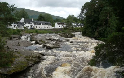
Falls of Dochart
Falls of Dochart: The Waterfall at the Heart of a Village Most waterfalls require a walk to find. The Falls of Dochart require no such effort at all — they run directly through the centre of Killin, beneath the old stone Bridge of Dochart, in full view of the...
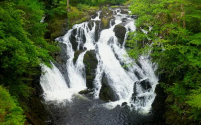
Swallow Falls
Swallow Falls: Wales' Highest Continuous Waterfall The River Llugwy has been performing for visitors at Swallow Falls for well over a century, and it still knows exactly what it is doing. The water tumbles 42 metres through a narrow, tree-lined gorge in a sequence of...
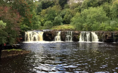
Wain Wath Force
Wain Wath Force: The Broadest Waterfall in Upper Swaledale Wain Wath Force will never win a prize for height. The River Swale drops only around a metre and a half here, sliding gently over a wide limestone ledge beneath the pale cliffs of Cotterby Scar. But what it...
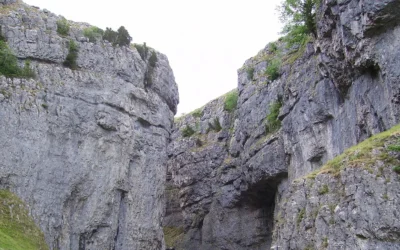
Gordale Scar
Gordale Scar: The Gorge That Stopped Wordsworth in His Tracks There is a moment as you walk the flat, pleasant path from Malham when the gorge closes around you without warning. The sky narrows to a strip above. The walls rear up on either side — overhanging...
Low Force
Low Force: Teesdale's Most Peaceful Waterfall High Force gets the crowds. Low Force gets the quiet. Just a mile and a half downstream from its more famous neighbour, where the River Tees spreads wide across a series of 18-foot cascades over the Whin Sill...