
Falls of Dochart
Falls of Dochart: The Waterfall at the Heart of a Village
Most waterfalls require a walk to find. The Falls of Dochart require no such effort at all — they run directly through the centre of Killin, beneath the old stone Bridge of Dochart, in full view of the village’s shops and cafés. Stand on that bridge and you are standing exactly where visitors have stood since 1760, watching the same river do the same thing it has always done: rush white and fast over a broad bed of dark rock, from a gentle summer trickle to a roaring winter torrent.
It is one of Scotland’s most accessible waterfalls, and also one of its most storied. Below the bridge sits Inchbuie — Innis Bhuidhe, “the yellow island” — the ancient burial ground of the chiefs of Clan MacNab, its walled enclosure visible from the bridge parapet. Few waterfalls anywhere combine this much drama, history and sheer convenience in one small Highland village.
Here is everything you need to plan a visit.
About the Falls of Dochart
The Falls of Dochart are a broad cascade of rapids on the River Dochart at Killin, in Loch Lomond and The Trossachs National Park. The Dochart rises on the slopes of Ben Lui and flows east through Glen Dochart — this stretch of river is, in fact, the upper reach of Scotland’s longest river, which is known successively as the Cononish, the Fillan and then the Dochart before it reaches Loch Tay at Killin, from where it continues eastward as the River Tay.
As the river approaches Killin, its bed broadens and its gradient steepens, producing the falls: not a single drop but a wide, turbulent spread of white water over exposed rock, famous above all for its extreme variability. In late summer, the flow can drop so low that most of the riverbed is visible between the rushing channels; after heavy rain, the same stretch becomes a raging, spray-filled torrent that completely covers the rocks.
The falls are spanned by the Bridge of Dochart, first built in 1760 to carry what is now the A827 across the river — a handsome multi-arched stone bridge that remains the best vantage point for the falls. Just downstream of the bridge lies Inchbuie (Gaelic Innis Bhuidhe, “yellow island”), a small wooded island that has been a significant site since the Iron Age, when two forts stood here.
Its most prominent feature today is an 18th-century walled burial enclosure — the ancient resting place of the chiefs of Clan MacNab, containing at least fifteen graves, including a rare medieval carved slab depicting a kilted warrior figure. The island was gifted to the MacNab Memorial Trust by the clan chief in 1987, ensuring it would remain in MacNab hands. It can be visited by arrangement — a key to the gate is held locally in the village.
Getting there
By car, from Glasgow take the A85 to Crianlarich and then the A827 to Killin — a journey of around 1.5 hours. From Edinburgh, allow roughly 2 hours via the M9 and A84. The falls are right in the village centre, impossible to miss as you cross the Bridge of Dochart.
By bus, services from Stirling and towns such as Callander serve Killin, with stops near the village centre — the falls are a five-minute walk from the bus stop.
On foot or bike, Killin sits on the Rob Roy Way (79 miles, Drymen to Pitlochry) and the Breadalbane Way, both long-distance routes that pass directly through the village, making the falls a natural waypoint for walkers tackling either trail.
If you’re staying further afield, Killin makes an easy day trip from Stirling, Callander or the wider Trossachs.
Compare Transfers & Local Transport in the Trossachs →
Where does the name come from?
The precise origin of “Dochart” is not conclusively documented — the Gaelic form of the river’s name is Dochard, but scholars have not settled on a definitive meaning. What is clear is that the river has carried this name, or a close variant, for a very long time, flowing from Ben Lui through Loch Dochart and Glen Dochart before reaching Killin. The village name itself, Killin, comes from the Gaelic Cill Fhionn, meaning “white church” — a reference to an early religious site rather than to the falls directly.
The walk and the trails
The Falls of Dochart Walk (around 2.3 km, 35–40 minutes, easy): A short loop from the village centre following the River Dochart to the falls and back through woodland, with mountain views along the way — an ideal introduction for families and casual visitors.
River Lochay and Loch Tay Circular (around 5 km, 1–2 hours, easy): A flat, scenic route along the River Lochay and the shore of Loch Tay, good for spotting red squirrels and otters, and suitable for most fitness levels.
Long-distance options: Killin sits on both the Breadalbane Way (around 50 miles, linking Callander to Loch Rannoch) and the Rob Roy Way (79 miles, Drymen to Pitlochry). Both pass directly through the village and offer the option of a shorter section walk taking in the falls, Loch Tay and the surrounding Highland scenery, or a full multi-day undertaking for more serious walkers.
Parking
Parking is available in Killin village, including a car park near the Falls of Dochart Inn — check current signage for any charges — as well as other village car parks that may offer free parking, though spaces are limited, especially in peak season and after heavy rain, when visitor numbers rise sharply. Arriving early is worthwhile in summer.
Facilities
Killin is a proper village with a full range of visitor facilities close to the falls: cafés, a gift shop, a small grocery store, and public toilets. On the north side of the river stands the building once known as the Breadalbane Folklore Centre — originally built as St Fillan’s Mill in 1840 to harness the river’s power. The Folklore Centre closed in 2011, and the building, now known as the Old Mill, has since become home to an arts and crafts shop, still well worth a browse.
Things to know before you go
Best time to visit. After sustained rain for the falls at their most dramatic and powerful — this is when the “raging torrent” character the falls are known for really comes alive. Spring and summer bring lush surrounding greenery and generally pleasant walking conditions; autumn adds vibrant Highland colour to the hills around Killin. Early mornings and late afternoons are quieter and give the best light for photography.
Dogs. Dogs are welcome throughout the village and on the surrounding trails but should be kept on a lead near the water and on the narrow bridge, which is shared with vehicles.
Accessibility. The paved path from the village to the Bridge of Dochart is relatively flat and manageable for most visitors. The immediate riverbank around the falls has more uneven, rocky terrain that may be more challenging for wheelchair users.
Families and safety. An easy and rewarding stop for families of all ages, given the short, level walk from the village. The bridge itself is narrow and shared with traffic — take care crossing with children. Rocks near the water can be slippery, especially after rain.
Swimming. Not recommended — the fast-flowing water and exposed rocks make the falls hazardous for swimming at any time of year.
Where to stay
Killin itself is the obvious base, offering a range of accommodation right beside the falls, with easy access to Loch Tay and the surrounding Breadalbane mountains.
Find Hotels & Stays in Killin →
What to pack
The village walk needs little, but longer routes on the Rob Roy Way or into the surrounding hills call for proper preparation.
- A pair of waterproof walking boots — useful even for the short falls walk in wet weather, and essential for any of the longer trails.
- A waterproof jacket and warm layers; Highland Perthshire’s weather is famously unpredictable.
- A pair of binoculars for spotting red squirrels and otters along the River Lochay and Loch Tay circular route, and for wider wildlife-watching around Ben Lawers.
- A travel tripod for long-exposure shots of the falls from the bridge, especially useful after rain when the water is at its most dramatic.
Nearby attractions and making a day of it
Killin sits at the meeting point of two rivers and centuries of Highland clan history, with plenty to explore within a short distance of the falls.
| Attraction | Why Visit | Distance |
|---|---|---|
| Inchbuie (Innis Bhuidhe) | The ancient walled burial ground of the chiefs of Clan MacNab, visible from the Bridge of Dochart — access by arrangement with a key held locally | Adjacent, below the bridge |
| Killin (Kinnell) Stone Circle | A well-preserved prehistoric stone circle of six standing stones, around 10 metres across, in the grounds of Kinnell House | ~0.5 miles |
| Finlarig Castle | Atmospheric 17th-century ruins built by the Campbells of Breadalbane, with an associated chapel, on the edge of the village | ~1 mile |
| Loch Tay | One of Scotland’s great Highland lochs, excellent for salmon fishing, watersports and scenic walks, beginning right at the edge of Killin | Adjacent |
| Ben Lawers National Nature Reserve | Internationally significant alpine plant habitat and one of Scotland’s highest mountains, with waymarked trails and the chance to spot golden eagles and red deer | A short drive |
For a full Killin day, walk the short falls loop, visit the stone circle and Finlarig Castle, and finish with a walk along the shore of Loch Tay.
Browse Loch Lomond & Trossachs Tours & Experiences →
Photography tips
The Bridge of Dochart is the classic vantage point — stand at its centre for a straight-on view of the falls cascading beneath, with the village and hills as a backdrop. The riverbank on either side offers alternative angles, particularly useful for capturing the falls alongside Inchbuie’s burial enclosure.
Early morning or late afternoon light gives the softest, most flattering conditions. Visit after rain for the fullest, most dramatic flow and the best mist effects. A tripod is genuinely useful for long-exposure shots that render the rushing water as smooth, silky threads against the dark rock — and for including the Highland mountains or village buildings for scale and context.
Conclusion
The Falls of Dochart ask almost nothing of the visitor and give back a great deal: a genuinely wild, ever-changing Highland waterfall, right in the heart of a village that has grown up around it, with an ancient clan burial ground and a historic bridge thrown in for good measure. Whether you spend two minutes on the bridge or a full day exploring the wider Breadalbane area, Killin’s falls reward every visit differently, depending entirely on how much rain has recently fallen on Ben Lui.
FAQs
How tall is the Falls of Dochart?
The Falls of Dochart are a series of rapids and small cascades rather than a single measured drop — their character comes from the wide, dynamic spread of water over rock rather than any specific height, and this spread varies dramatically with rainfall.
Is there a fee to visit the Falls of Dochart?
No entry fee is required to view the falls, which are freely visible from the Bridge of Dochart and the village. Parking in Killin may carry a small charge at some car parks; check current signage on arrival.
What is the best time to visit the Falls of Dochart?
After sustained rain for the most powerful and dramatic flow. Spring and summer bring lush surrounding greenery, while autumn adds rich Highland colour to the hills around the village.
Are dogs allowed at the Falls of Dochart?
Yes, dogs are welcome but should be kept on a lead near the water and while crossing the narrow bridge, which is shared with vehicles.
Is the Falls of Dochart accessible for wheelchairs?
The paved path from the village to the Bridge of Dochart is relatively flat and manageable for most visitors, though the immediate riverbank has more uneven terrain that may pose challenges.
What are the parking options at the Falls of Dochart?
Parking is available in Killin village, including a car park near the falls where charges may apply, as well as other village car parks that may offer free parking. Spaces are limited in peak season.
Can I swim at the Falls of Dochart?
No — the fast-flowing water and exposed rocks make swimming hazardous at any time of year.
What should I wear when visiting the Falls of Dochart?
Sturdy shoes and weather-appropriate clothing, including rain gear, as Highland weather is unpredictable.
Can I visit the MacNab burial ground on Inchbuie?
Yes, by arrangement. The island is visible from the Bridge of Dochart, and a key to the gate can be obtained locally in the village — ask at the library or a local shop for current arrangements.
What’s nearby?
Inchbuie and its MacNab burial ground (adjacent), the Killin/Kinnell Stone Circle (~0.5 miles), Finlarig Castle (~1 mile), Loch Tay (adjacent) and the Ben Lawers National Nature Reserve (a short drive).
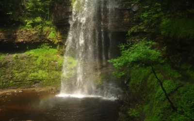
Henrhyd Falls
Henrhyd Falls: South Wales' Tallest Waterfall — and the Batcave The path descends steeply from the car park through sessile oak and ash woodland, and the sound of the water grows before the falls are visible. Then the gorge opens, and Henrhyd Falls drops the full...
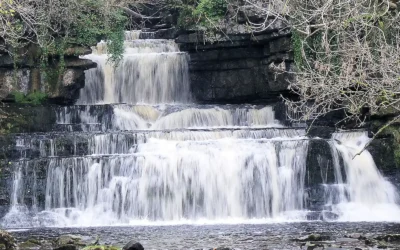
Cotter Force
Cotter Force: Wensleydale's Most Accessible Waterfall Most waterfall walks in the Yorkshire Dales involve a certain amount of commitment — boggy ground, uneven paths, steep descents, a scramble at the end. Cotter Force is different. A level, compacted stone path...
Brontë Waterfall
Brontë Waterfall: A Literary Pilgrimage on the Yorkshire Moors The path from Haworth leads you out of the cobbled streets, past the old church and through kissing gates, and into the wide, windswept moors of West Yorkshire — the same moors that Charlotte, Emily and...
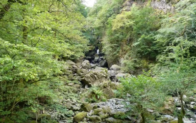
Lodore Falls
Lodore Falls: The Cascade That Inspired a Poem Stand beside Lodore Falls after heavy rain and you begin to understand why Robert Southey, the Poet Laureate who lived at Greta Hall just up the road in Keswick, reached for so many words at once. Dashing and flashing and...
Scale Force
Scale Force: The Lake District's Highest Waterfall You hear the roar before you see it. Then the gorge opens, the trees close in from above, and a single white ribbon of water drops 120 feet in one clean plunge before gathering itself again and falling further...