
Low Force
Low Force: Teesdale's Most Peaceful Waterfall
High Force gets the crowds. Low Force gets the quiet. Just a mile and a half downstream from its more famous neighbour, where the River Tees spreads wide across a series of 18-foot cascades over the Whin Sill dolerite, Low Force is the waterfall that rewards the visitors who linger a little longer in Teesdale.
It is also the site of the Wynch Bridge — a wrought-iron chain suspension footbridge that has spanned the Tees here since 1830, and which replaced a predecessor built in 1741 that was, in its time, considered England's first chain suspension bridge. The bridge wobbles considerably when you cross it. The signs at each end recommend crossing one person at a time. Once across, standing on the narrow timber deck above the gorge with the Tees rushing below, that recommendation begins to seem very sensible.
One more footnote for the film enthusiasts: in June 2019, this stretch of the Tees was transformed into the battlefields of the First World War. Sam Mendes' film 1917 was shot here; the production team erected signs along the Pennine Way warning walkers not to be alarmed by the prosthetic bodies. The Tees looked convincingly like northern France.
Here is everything you need to plan a visit.
About Low Force
Low Force is an 18-foot (5.5-metre) series of cascades on the River Tees, located near Bowlees in County Durham, within the North Pennines Area of Outstanding Natural Beauty and European Geopark. The falls spread across the full width of the river in a broad, stepped sequence, without the single dramatic plunge of High Force upstream — the Tees here divides around a rocky wooded island and tumbles through both channels over the Whin Sill, the same hard dolerite intrusion that underpins much of Upper Teesdale's waterfall scenery.
The falls were formerly known as Salmon Leap — the name is self-explanatory, and Atlantic salmon still attempt the run upstream during the autumn spawning season. The Tees also floods dramatically here after sustained rain; the flash-flood character of the upper river can turn the gentle cascades into a roaring spectacle when the moorland above is saturated.
The immediate setting — broadleaved woodland, wildflower-rich riverbanks in spring and early summer, and the swing of the Wynch Bridge at the lower end — makes Low Force one of the most photographed and most peaceful waterfall locations in the North Pennines.
Getting there
By car, the starting point is the Bowlees Visitor Centre (DL12 0XF) on the B6277, around three miles northwest of Middleton-in-Teesdale. Free parking is available at the visitor centre and in laybys along the B6277. From the car park, the walk to Low Force takes around 15 minutes along a well-marked path.
By public transport, Middleton-in-Teesdale is the closest town with bus links from Darlington and Barnard Castle; check Traveline for current services to Middleton. From Middleton the walk to Bowlees is around three miles along the B6277, or the Pennine Way offers a more scenic off-road approach.
For those visiting as part of a longer Teesdale day, both High Force and Cauldron Snout (England's longest waterfall) are within easy reach.
Compare Transfers & Local Transport in Teesdale →
Where does the name come from?
Force is the Old Norse word fors for a waterfall — heard across northern England from Aira Force in the Lake District to High Force and Cauldron Snout upstream. Low simply distinguishes it from High Force, the more powerful fall further up the Tees.
The Wynch Bridge takes its name from the winch mechanism used to tension and adjust the iron chains of the original 18th-century structure — a practical name for a practical piece of engineering. Local lead miners needed a reliable crossing of the Tees here; the gorge was too deep and too fast to ford safely, and the bridge — precarious as it looked — was the solution.
The walk and the trails
Short walk from Bowlees (1 mile return, 30 minutes, easy): From the Bowlees Visitor Centre car park, cross the road and follow the signed footpath along the north bank of the Tees. The path passes a distinctive stone sheep sculpture before reaching the Wynch Bridge. Cross the bridge (one person at a time — it wobbles genuinely) to reach the best view of the cascades. The falls spread across the full width of the river on both sides of the wooded central island.
Low and High Force circular (5 miles, 2–3 hours, moderate): Continue upstream from Low Force along the Pennine Way to High Force, returning by a different path through the woodland above the river. This is the natural combination — seeing both Teesdale waterfalls in a single morning.
High and Low Force from Middleton-in-Teesdale (7–8 miles, 3–4 hours, moderate to challenging): A longer loop starting from the town, following the Pennine Way upstream to both falls and returning via a higher path. This is one of the finest Pennine Way day walks.
The Pennine Way passes directly alongside Low Force and is the main route for long-distance walkers moving north. The Teesdale section of the Pennine Way through the spring wildflower season (May to early June) is particularly celebrated: the riverside meadows carry rare arctic-alpine plants including the Teesdale violet, spring gentian and bird's-eye primrose, species that have survived here since the last Ice Age.
Parking
Bowlees Visitor Centre (DL12 0XF) has a free car park with a suggested donation for maintenance — a voluntary honesty contribution. Additional free parking exists in laybys along the B6277. Spaces fill on fine summer weekends; arriving early in the morning is the surest way to park easily.
Facilities
Bowlees Visitor Centre (Natural England) has public toilets, a tearoom, an information room and a picnic area — a very welcome facility for an otherwise remote stretch of Teesdale. The tearoom is a warm and practical stop before or after the walk; check Natural England's website for current seasonal opening days.
There are no facilities on the path to the falls or at the falls themselves.
Things to know before you go
Best time to visit. After heavy rain for the most dramatic flow, when the Tees fills both channels and the cascades merge. Spring (May–June) is exceptional for the rare arctic-alpine wildflowers along the riverbank. Autumn sees Atlantic salmon attempting the cascades. Winter can be atmospheric but the path can be muddy and the Wynch Bridge should be avoided in high winds.
The Wynch Bridge. Cross one person at a time — this is a genuine recommendation, not a cautionary formality. The bridge wobbles substantially; it was last strengthened in 1992 but remains a chain suspension bridge and should be respected as such.
Dogs. Dogs are welcome but should be on leads near the river and around the livestock that graze the surrounding meadows.
Accessibility. The path from Bowlees to Low Force is mostly level but uneven in places. The Wynch Bridge is not suitable for wheelchairs. Contact Bowlees Visitor Centre for current accessibility information.
Families and safety. An excellent short walk for families. The falls are gentle compared to High Force, but the river is deep in places and the rocks are slippery. Keep children away from the edge of the gorge and the riverbank.
Swimming. The wide pools beside the wooded island are used for wild swimming, but the water is extremely cold year-round. Strong swimmers only, never in high flow after rain, and never alone.
Where to stay
The natural base is Middleton-in-Teesdale, three miles southeast on the B6277 — the market town of Upper Teesdale with a good range of accommodation, shops and cafés. For more options, Barnard Castle, around 10 miles southeast, offers the widest choice in the area.
Find Hotels & Stays in Middleton-in-Teesdale →
What to pack
The walk is short, but the Teesdale weather and the riverside terrain warrant some preparation.
- A pair of waterproof walking boots with good grip — the path is uneven, the rocks near the falls are permanently damp, and the B6277 laybys can be muddy in wet weather.
- A waterproof jacket and warm layers; the North Pennines moorland weather is changeable in all seasons.
- A pair of binoculars — the Tees at Low Force is excellent for dippers, grey wagtails, kingfishers and, in autumn, Atlantic salmon attempting the cascades.
- A travel tripod for long-exposure shots of the cascades and the Wynch Bridge from the riverbank.
An OS Explorer OL31 map is worth carrying for the longer Teesdale circuits.
Nearby attractions and making a day of it
Low Force is the gentler half of the Teesdale waterfall pair, and the surrounding dale has much to reward a longer visit.
| Attraction | Why Visit | Distance |
|---|---|---|
| High Force | England's most powerful waterfall by volume — 21 metres of the River Tees over the Whin Sill in a 700-metre gorge, best seen after heavy rain | ~1.5 miles upstream |
| Bowlees Visitor Centre | Natural England's visitor centre with tearoom, toilets and information — the natural start and end point for any Teesdale waterfall walk | At the car park |
| Middleton-in-Teesdale | The market town of Upper Teesdale — cafés, shops, the start of several Pennine Way sections and a pleasing traditional market town character | ~3 miles |
| Barnard Castle | A handsome market town with a ruined Norman castle above the Tees and the extraordinary Bowes Museum — a French-style château housing one of the finest art collections outside London | ~10 miles |
| Cauldron Snout | England's longest waterfall — 200 yards of Whin Sill cataract at the outlet of Cow Green Reservoir, accessible via the Pennine Way | ~9 miles upstream |
For a classic Teesdale waterfall day, walk from Bowlees to Low Force, continue to High Force, and return via the woodland above the Tees.
Browse North Pennines & Teesdale Tours →
Photography tips
The widest views of Low Force are from the Wynch Bridge itself — looking upstream at the full spread of the cascades across both channels and the wooded island. A wide-angle lens captures the bridge, the gorge and the falls in one composition; a longer exposure smooths the water.
From the south bank, slightly upstream of the bridge, the cascades spread broadly across the frame with the Pennine Way path and the woodland bank providing depth and context. Overcast conditions give the most even light in this shaded, north-facing gorge. After rain, both channels run full and the effect is far more powerful than in dry summer weather.
The Wynch Bridge itself is a strong subject — the wrought iron and timber structure, swaying gently above the gorge, has changed very little since 1830.
Conclusion
Low Force is the waterfall you find once you have seen High Force and decided to stay a little longer in Teesdale. The cascades are gentler, the bridge is older, the Pennine Way quieter. In spring, the riverbank carries flowers that have grown here since the Ice Age. In autumn, salmon push upstream through the same water that lead miners once crossed by chain bridge. It is a place that accumulates meaning the more time you spend in it.
FAQs
How tall is Low Force?
Low Force is 18 feet (5.5 metres) — a series of cascades rather than a single drop, spreading across the full width of the River Tees where it flows over the Whin Sill dolerite and around a wooded central island.
Is there a fee to visit Low Force?
No — the falls, the Wynch Bridge and all paths are free to visit. Parking at Bowlees Visitor Centre is free with a voluntary donation suggested; the B6277 laybys are also free.
What is the best time to visit Low Force?
After heavy rain for the fullest flow. Spring (May–June) for the rare Teesdale wildflowers along the Pennine Way. Autumn for Atlantic salmon attempting the cascades.
Are dogs allowed at Low Force?
Yes, on leads near livestock in the surrounding meadows and near the edge of the gorge.
Is Low Force accessible for wheelchairs?
The path from Bowlees to the falls is mostly level but uneven. The Wynch Bridge is not wheelchair accessible. Contact Bowlees Visitor Centre for current accessibility guidance.
What are the parking options at Low Force?
Free parking at Bowlees Visitor Centre (DL12 0XF), with a voluntary donation. Free laybys on the B6277 nearby. Both can fill quickly on summer weekends.
Is the Wynch Bridge safe to cross?
Yes, but the signs at each end recommend crossing one person at a time — the bridge wobbles considerably and this is a genuine caution. It was last strengthened in 1992.
Can I swim at Low Force?
The pools beside the wooded island are used for wild swimming, but the water is extremely cold year-round. Strong swimmers only, never after heavy rain, and never alone.
Was Low Force really in a film?
Yes — Sam Mendes filmed part of 1917 here in June 2019. The production team installed signs along the Pennine Way warning walkers not to be alarmed by the prosthetic bodies on the riverbank.
What's nearby?
High Force (~1.5 miles), Bowlees Visitor Centre (at the car park), Middleton-in-Teesdale (~3 miles), Barnard Castle (~10 miles) and Cauldron Snout (~9 miles).
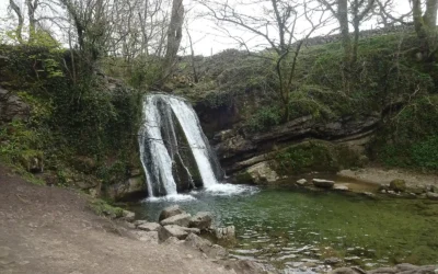
Janet’s Foss
Janet's Foss: The Fairy Queen's Waterfall in the Yorkshire Dales There is a moment, walking through the woodland on the path from Malham, when the trees close in, the sound of water rises, and a small but perfectly formed waterfall appears in a mossy dell ahead of you...
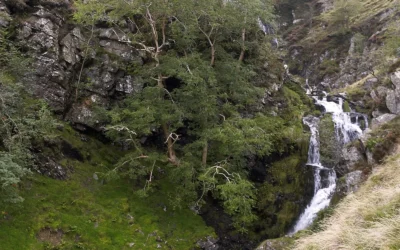
Cautley Spout
Cautley Spout: England's Highest Cascade Waterfall You are walking a level path through a broad, treeless valley when the Howgill Fells suddenly drop away on your left, and there — streaming down the whole face of the cliff — is Cautley Spout. Not a single...
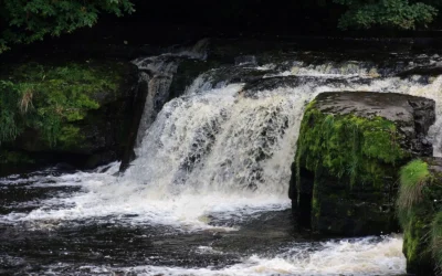
Aysgarth Falls
Aysgarth Falls: Wensleydale's Three-Stage Waterfall You hear them before you see them. Walking down through Freeholders' Wood, the sound of the River Ure builds steadily until you round a bend and the whole river spreads itself across a series of broad...
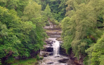
Falls of Clyde
Falls of Clyde: Scotland's Four Waterfalls on the River Clyde Stand at the Corra Linn viewpoint after heavy rain and the whole River Clyde seems to gather itself and throw itself over the edge — twenty-six metres of white water crashing into a wooded gorge, the...
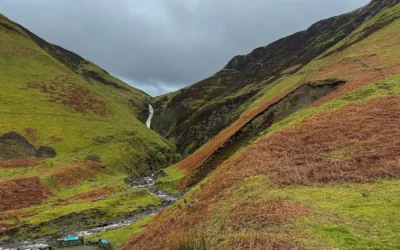
Grey Mare’s Tail
Grey Mare's Tail: The 60-Metre Cascade That Hides a Secret Loch Above It Most people who pull into the car park below Grey Mare's Tail come for the waterfall — a tall, thin ribbon of white water dropping 60 metres down a craggy cliff into the Moffat Water valley. And...