
East Gill Force
East Gill Force: Where Two Great Walks Meet
There is a particular pleasure in arriving at East Gill Force. You have walked the short path from Keld, crossed the long stone footbridge over the River Swale, and then the path turns and the waterfall is simply there — the upper fall dropping fifteen feet over a limestone ledge into a pool, the lower section cascading in steps down to the Swale below.
It is modest in scale. But the setting is perfect: broadleaved woodland pressing in on both sides, the clear water moving fast and cold, and the knowledge that you are standing at the exact point where the Pennine Way and the Coast to Coast Walk cross.
Every long-distance walker who travels these two great paths passes East Gill Force. Alfred Wainwright, who devised the Coast to Coast, knew this stretch of Swaledale well. The hamlet of Keld, just a few minutes away, is one of the most remote in the Yorkshire Dales — fewer than a hundred residents, no mobile phone signal on the fells above, and a concentration of four separate waterfalls within a short walk of each other that is almost certainly unequalled anywhere in northern England.
Here is everything you need to plan a visit.
About East Gill Force
East Gill Force sits on the East Gill, a small stream descending from East Stonesdale Moor, at the point where it meets the River Swale — 330 yards east of the hamlet of Keld, in the Yorkshire Dales National Park. It has two distinct sections: the upper falls drop 15 feet (4.5 metres) in a clean, compact plunge over a limestone lip; the lower section is a series of stepped cascades that drop a further 10 feet (3 metres) as the East Gill enters the Swale at the base of the footbridge.
It is one of four waterfalls concentrated in and around Keld, all occurring where the Swale and its tributaries cut through carboniferous limestone between the flanks of Kisdon Hill and Rogan’s Seat. The others are Kisdon Force (hidden in a deep gorge downstream, with a 10-metre drop), Catrake Force (upstream, a series of four stepped drops accessible through the campsite) and Wain Wath Force (0.6 miles upstream, broad and open, excellent for paddling). Together they make the Keld area one of the finest waterfall landscapes in the Dales.
East Gill Force is the most accessible of the four — right on the main path out of the village, clearly visible and easily reached.
Getting there
By car, Keld sits on the B6270, the road running along the floor of Swaledale between Kirkby Stephen to the northwest and Reeth to the east. From Richmond, follow the B6270 west through Reeth and Muker — a drive of around 25 miles through some of the most scenic dale country in Yorkshire. From Hawes, the most dramatic approach is over the Buttertubs Pass via Thwaite — a famous high moorland road with vertiginous limestone potholes beside the carriageway.
The parking for the falls is on the B6270 beside the road, or in the honesty-box car park at Rukin’s Campsite in Keld village — a short walk from the waterfall. Check the signs on site for current charges.
By public transport, Keld is not served by any regular bus route. The closest transport links are in Muker (2.5 miles southeast) and Hawes (around 11 miles). Visiting by public transport would require a taxi from Muker or Hawes, or arriving as part of a long-distance walking route.
If you’re staying further afield, the nearest town with a good accommodation base is Leyburn, around 20 miles to the east.
Compare Transfers & Local Transport in the Yorkshire Dales →
Where does the name come from?
Force is Old Norse for a waterfall — the same Norse influence that names waterfalls across the north of England, from Aira Force in the Lakes to Cauldron Snout in the Pennines. Gill is Old Norse for a narrow ravine or stream — the gill carries the water down from the moor before it tumbles at East Gill Force into the Swale. The “East” simply distinguishes it from other gills and forces in the valley.
Keld itself derives from Kelda, the Old Norse word for a spring — the village was once known as Appletre Kelde, “the spring by the apple trees,” a name that captures the Viking agricultural settlement that took root here over a thousand years ago.
The walk and the trails
The short walk from Keld to East Gill Force (around 10 minutes each way, straightforward) starts from the road at the top of Keld village. The path descends to a long stone footbridge over the River Swale and crosses to the south bank. East Gill Force is immediately visible from the bridge. Allow time to explore both the upper falls and the lower stepped section at the confluence with the Swale.
For those who want more, East Gill Force is the natural starting point for the Keld Waterfalls Circuit — a circular walk of around 4 miles taking in all four of Keld’s waterfalls. From East Gill Force, the path continues to Kisdon Force (hidden in a gorge 500 metres downstream, requiring a steep descent — worth it for the full 10-metre drop); Catrake Force (upstream via the campsite, a series of four stepped drops); and Wain Wath Force (broad, open and excellent for paddling, 0.6 miles upstream on the B6270). This circuit is one of the finest short walks in Swaledale.
Crackpot Hall offers an excellent extension — a further ~1 mile along the north bank of the Swale from East Gill Force, climbing to the ruined farmhouse on the hillside above the dale. The name, despite appearances, is nothing eccentric: it derives from the Old Norse and Old English for “a deep hole haunted by crows” — a reference to the limestone cave country of the hillside above.
The ruins were abandoned in the 1950s after lead-mining subsidence made them uninhabitable, but the site dates to at least a 16th-century hunting lodge. The views from the ruins, across the full width of Swaledale below, are exceptional.
For long-distance walkers, both the Pennine Way and the Coast to Coast Walk pass through Keld and cross at East Gill Force. The Pennine Way heads north from here toward Tan Hill and eventually the Scottish border; the Coast to Coast turns east for Reeth and Richmond on its way to the North Yorkshire coast.
Parking
Roadside parking exists beside the B6270 near the turning for Keld village, with a small layby. The main car park option is the honesty box at Rukin’s Campsite in Keld, which has space for several cars and provides toilets and shower facilities for a small charge. Check the signs on site for current charges. There is no formal car park specifically for the falls.
Facilities
Keld is small but not without resources. Park Lodge operates a tearoom and small shop from Easter through to autumn — an ideal stop for walkers. The Keld Countryside and Heritage Centre (open year-round) provides background on the history of Upper Swaledale, including the lead-mining heritage and the Viking settlement of the dale. Toilets are available at Rukin’s Campsite for a small charge.
There are no facilities at the waterfall itself — no shelter, café or staffed presence.
Things to know before you go
Best time to visit. Spring after rain for the fullest flow, and spring also brings the famous Muker Meadows wildflowers a couple of miles downstream. Autumn turns the broadleaved woodland around the falls to gold. In dry summer spells, the East Gill can reduce to a trickle; the falls are always pretty, but far more impressive after rain.
Wild swimming. The pool at the base of the upper falls is a popular paddling and swimming spot in warm weather. The water is cold, clear and fast-moving; take the usual precautions — strong swimmers only in deeper water, never after heavy rain when the current is powerful. Wain Wath Force upstream is generally considered a safer and calmer swimming spot.
Dogs. Dogs are welcome and should be kept on leads around the free-roaming livestock that graze in the surrounding fields and valley floor.
Accessibility. The path from the road to the falls involves a descent on a stepped stone path with a railing — not suitable for wheelchairs or pushchairs, but manageable for most mobile visitors.
Families. An excellent short walk for families. The falls are right next to the main path with no long approach, and the pools invite paddling. Keep young children away from the bank of the Swale, which runs fast and deep after rain.
Navigation note. The junction of the Pennine Way and the Coast to Coast at Keld can be briefly confusing — follow the signs for East Gill Force specifically if you want the falls, rather than continuing on either long-distance route.
Where to stay
Keld itself has accommodation at Keld Lodge (a hotel and restaurant at the top of the village). For more options, the nearest base with a good range of accommodation is Leyburn, around 20 miles east down the dale — a proper market town with shops, cafés and rail-linked transport.
Find Hotels & Stays in Leyburn →
What to pack
The path is short, but the Yorkshire Dales weather and the wet, slippery rocks near the water are worth preparing for.
- A pair of waterproof walking boots — the stepped path is slippery in wet weather, and the rocks around the plunge pool are permanently damp.
- A waterproof jacket and warm layers; upper Swaledale weather is changeable and exposed above the valley floor.
- A pair of binoculars — the dale is excellent for curlew, lapwing, peregrine and, in the woodland around the falls, dippers and grey wagtails.
- A travel tripod for long-exposure shots of the cascades and the stepped lower section.
An OS Explorer OL30 map is useful for the Keld circuit walk and for the Crackpot Hall extension.
Nearby attractions and making a day of it
Keld and upper Swaledale are one of the richest short-walk landscapes in the Yorkshire Dales.
| Attraction | Why Visit | Distance |
|---|---|---|
| Kisdon Force | Keld’s most dramatic waterfall — a hidden 10-metre plunge in a wooded gorge on the Swale, accessed via a steep path from the Pennine Way | ~500m from East Gill Force |
| Wain Wath Force | A broad, open waterfall on the Swale — excellent for paddling and one of the most accessible waterfalls in upper Swaledale | ~0.6 miles upstream |
| Crackpot Hall | A ruined 18th-century farmhouse on the hillside above the dale, with exceptional views down Swaledale — the name derives from Old Norse/Old English for “a crow’s pothole” | ~1 mile |
| Muker village & meadows | A beautiful upper Dales village with a tearoom, a church, and the finest wildflower hay meadows in England — at their best in late May and June | ~2.5 miles |
| Buttertubs Pass | One of England’s most dramatic roads, crossing the high moorland between Swaledale and Wensleydale via limestone potholes that give the pass its name | ~3 miles |
For a full Keld day, walk the four-waterfall circuit in the morning, extend to Crackpot Hall for the views, and then drive to Muker for tea.
Browse Yorkshire Dales Tours & Experiences →
Photography tips
East Gill Force rewards different approaches at different times of day. The upper falls photograph best from directly in front, with the pool below in the frame — a wide angle captures both the drop and the moss-covered setting. The lower stepped section, where the gill meets the Swale, gives a longer, more horizontal composition with the stone bridge as a natural frame.
A tripod and long exposure work well in the shaded gorge: the water smooths into threads and the surrounding stone and woodland come forward. Overcast conditions are better than direct sun, which creates harsh contrast between the white water and the dark rock. Visit after rain for the fullest flow. Early morning in autumn, with mist over the Swale visible through the trees, is a particularly rewarding time.
Conclusion
East Gill Force is not trying to impress you with its height. What it offers is something rarer: a perfect setting, a short and satisfying approach, and a location that has been meaningful to travellers for centuries. Every walker on the Pennine Way and the Coast to Coast passes here. Keld’s four waterfalls, the ruined hall above the dale, the Norse names in every feature of the landscape — this is the Yorkshire Dales at its most concentrated and most rewarding.
FAQs
How tall is East Gill Force?
The upper falls drop 15 feet (4.5 metres) in a clean plunge; the lower section is a series of stepped cascades dropping around 10 feet (3 metres) as East Gill enters the River Swale.
Is there a fee to visit East Gill Force?
No — the falls and all paths are free to visit. Parking at Rukin’s Campsite honesty box has a small charge; check the signs on site for the current amount.
What is the best time to visit East Gill Force?
Spring after rain for the fullest flow. Autumn for woodland colour. The falls are pleasant year-round, but in dry summer spells the East Gill can reduce significantly.
Are dogs allowed at East Gill Force?
Yes, but on leads around livestock in the surrounding fields and on the valley floor.
Is East Gill Force accessible for wheelchairs?
The path involves a stepped stone descent with a railing, and is not suitable for wheelchairs or pushchairs.
What are the parking options at East Gill Force?
Roadside parking beside the B6270 near Keld, or the honesty-box car park at Rukin’s Campsite in the village — check on site for the current charge.
Can I swim at East Gill Force?
The pool below the upper falls is used for wild swimming in warm weather. The water is cold and fast-moving; strong swimmers only, never after heavy rain. Wain Wath Force upstream is a calmer alternative.
What should I wear when visiting East Gill Force?
Sturdy waterproof footwear and a waterproof jacket. The rocks near the falls are permanently wet and slippery.
Is East Gill Force on the Pennine Way or Coast to Coast?
Yes — both the Pennine Way and the Coast to Coast Walk pass directly alongside East Gill Force. The two routes cross at Keld, making this one of the most walked waterfall locations in northern England.
What’s nearby?
Kisdon Force (~500m), Wain Wath Force (~0.6 miles), Crackpot Hall (~1 mile), Muker village and the Muker Meadows (~2.5 miles), and the Buttertubs Pass (~3 miles).
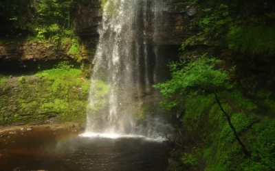
Henrhyd Falls
Henrhyd Falls: South Wales' Tallest Waterfall — and the Batcave The path descends steeply from the car park through sessile oak and ash woodland, and the sound of the water grows before the falls are visible. Then the gorge opens, and Henrhyd Falls drops the full...
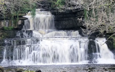
Cotter Force
Cotter Force: Wensleydale's Most Accessible Waterfall Most waterfall walks in the Yorkshire Dales involve a certain amount of commitment — boggy ground, uneven paths, steep descents, a scramble at the end. Cotter Force is different. A level, compacted stone path...
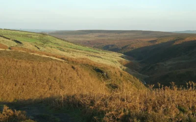
Brontë Waterfall
Brontë Waterfall: A Literary Pilgrimage on the Yorkshire Moors The path from Haworth leads you out of the cobbled streets, past the old church and through kissing gates, and into the wide, windswept moors of West Yorkshire — the same moors that Charlotte, Emily and...
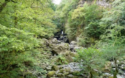
Lodore Falls
Lodore Falls: The Cascade That Inspired a Poem Stand beside Lodore Falls after heavy rain and you begin to understand why Robert Southey, the Poet Laureate who lived at Greta Hall just up the road in Keswick, reached for so many words at once. Dashing and flashing and...
Scale Force
Scale Force: The Lake District's Highest Waterfall You hear the roar before you see it. Then the gorge opens, the trees close in from above, and a single white ribbon of water drops 120 feet in one clean plunge before gathering itself again and falling further...