
Cauldron Snout
Cauldron Snout: England's Longest Waterfall
Most waterfalls announce themselves with a sudden vertical drop. Cauldron Snout does something different: it unrolls. From below, the River Tees is white and relentless for two hundred yards, cascading down the black dolerite steps of the Whin Sill in eight distinct drops, with a total descent of around sixty metres before the water finally settles again and resumes its journey downstream to High Force and beyond. It is not England's tallest waterfall — that distinction belongs to others — but it is widely reckoned to be the longest: a continuous cataract of a length and power that no other waterfall in England quite matches.
It sits at the end of a three-kilometre walk from the Cow Green Reservoir car park, deep in the North Pennines, on the border between County Durham and the old county of Westmorland. The Pennine Way passes directly alongside it. In a dry spell, the dam above regulates the flow. After sustained rain, Cauldron Snout becomes the roaring, foaming spectacle that drew a succession of Romantic visitors in the 19th century — and which Letitia Elizabeth Landon described in verse for Fisher's Drawing Room Scrap Book in 1835, alongside an engraving of the cataract by Thomas Allom.
Here is everything you need to plan a visit.
About Cauldron Snout
Cauldron Snout is a cataract on the upper River Tees, immediately below the dam wall of the Cow Green Reservoir, within the North Pennines Area of Outstanding Natural Beauty and European Geopark. It is more accurately described as a long cataract than a conventional waterfall — not a single dramatic plunge, but a sequence of eight stepped drops over the dolerite rock of the Whin Sill, a hard igneous intrusion that shapes much of Upper Teesdale's dramatic scenery (the same geology gives High Force its great vertical drop, further downstream).
At 200 yards (180 metres) in length and with a total descent of around 200 feet (60 metres), it is reckoned to be England's longest waterfall. The name is vivid and accurate: the churning, frothing descent into the gorge below does resemble a cauldron at full boil; "snout" refers to the narrow outflow where the water concentrates and accelerates before each new drop.
One important piece of context: the Cow Green Reservoir dam, built between 1967 and 1971 to supply water to Teesside industries, sits directly above the cataract. Its construction was controversial — it flooded part of the habitat of the rare Teesdale violet and other arctic-alpine plants — and it permanently changed the flow at Cauldron Snout. In dry weather, the regulated compensation flow can make the falls relatively modest; after heavy rain and high releases from the reservoir, the cataract returns to something close to its pre-dam character.
The site lies within the Moor House–Upper Teesdale National Nature Reserve — England's largest National Nature Reserve — where the moorland flora and geology have international significance.
Getting there
By car, follow the B6277 northwest from Barnard Castle or Middleton-in-Teesdale towards Langdon Beck. At Langdon Beck, a minor road on the left (signed for Cow Green Reservoir) runs alongside the valley to the reservoir car park — a drive of around 20 miles from Barnard Castle. The final section of road is narrow and single-track; drive carefully, especially on weekends.
By public transport, the options are very limited. Middleton-in-Teesdale is the nearest town with regular bus connections to Barnard Castle and beyond. From Middleton, the road to Cow Green has no regular bus service; a taxi or car hire is the practical alternative. Check Traveline for any current services, but do not rely on a bus.
The walk itself, from car park to cataract and back, is 3 kilometres each way along a clear, mostly well-surfaced path. Allow around 80–100 minutes for the out-and-back. For a longer circuit incorporating the reservoir's eastern shore, add another hour.
If you're arriving from further afield, Middleton-in-Teesdale or Barnard Castle are the logical bases, both with accommodation and good road access to the B6277.
Compare Transfers & Local Transport in Teesdale →
Where does the name come from?
Cauldron describes the boiling, churning pool at the base of each drop in the cataract — the churning of white water over black rock that so struck the Romantic visitors of the 18th and 19th centuries. The word traces back through French and Latin to the idea of something heated and violently agitated. Snout most likely refers to the narrow projection or outflow where the river concentrates before pouring over each step. Taken together, the name is one of the most evocative in English waterfall geography: neither embellished nor understated.
The walk and the trails
From the Cow Green Reservoir car park (NY810309), the path to Cauldron Snout is 3 kilometres each way — easy to follow, mostly well-surfaced tarmac to the dam, then a rougher stony path alongside the River Tees.
From the car park, follow the path south along the reservoir's western shore. At the dam, the Pennine Way continues southeast along the Tees. The character changes here: the path becomes rocky and uneven, following the river above the cliffs of Falcon Clints — impressive Whin Sill outcrops — with sections of boulder-hopping and, after rain, some muddy stretches. There are duckboards over the boggiest sections.
The sound reaches you before the sight: a steady, building roar as the Tees begins its descent. Then the cataract appears, wide and white and relentless against the dark rock. The full length is best appreciated from the path alongside the falls, where you can walk beside all eight drops. A short scramble to the right leads up to the dam wall above, giving a bird's-eye view of the full cataract below.
For those continuing on the Pennine Way in either direction, Cauldron Snout sits on the long-distance route between Middleton-in-Teesdale (downstream, ~9 miles) and Dufton (over the moorland to the west). The section through Falcon Clints and Cronkley Scar, extending a few miles downstream from the cataract, is one of the finest stretches of the whole Pennine Way.
Parking
The Cow Green Reservoir car park (grid ref. NY810309) is the only practical parking option — a small free car park at the end of the minor road from Langdon Beck. Some recent visitors have noted that a small charge may apply; check for signs on arrival and see the Natural England website for any updates. The car park has no facilities; the nearest café and toilets are at Bowlees Visitor Centre, around five miles down the B6277 towards Middleton-in-Teesdale.
Arrive early on fine weekends, as spaces are limited.
Facilities
There are no facilities at the car park or on the trail — no café, no toilets, no shelter. The moorland is remote and entirely undeveloped. Come fully self-sufficient: food, water, waterproofs and a map.
The nearest facility is the Bowlees Visitor Centre (Natural England), around five miles southeast on the B6277, which has toilets, information and light refreshments. Middleton-in-Teesdale, about six miles from the car park, has shops, cafés and services.
Things to know before you go
Best time to visit. After heavy and sustained rain for the most powerful flow, when the dam releases at full rate and the cataract returns to something close to its Victorian scale. Spring and autumn generally give more reliable flow than summer; winter is possible but requires full hill-walking kit and care on icy rocks. The early summer moorland is exceptional for rare wildflowers — the North Pennines support arctic-alpine plants surviving from the last Ice Age.
Wildlife. The Moor House–Upper Teesdale National Nature Reserve surrounds the walk. Red grouse, golden plover, curlew, wheatear and merlin all nest here. In the river, dippers and grey wagtails are regular. The moorland flora — Teesdale violet, spring gentian, bird's-eye primrose — is nationally significant; stay on the path.
Dogs. Dogs are welcome but must be on leads in the National Nature Reserve, near ground-nesting birds (spring and summer) and near livestock.
Accessibility. The path from the car park to the dam is tarmacked and relatively level. The section from the dam to the cataract is rocky, uneven and muddy in places — not suitable for wheelchairs or pushchairs. The cataract itself involves a scramble if you want the view from the base.
Families and safety. The walk to the dam is suitable for families. The section beyond, and particularly the scramble alongside the falls, demands care — unfenced drops, slippery rock. Keep children close near the cataract and near the unguarded reservoir dam.
Swimming. Not recommended — strong currents, cold water and the unpredictable releases from the reservoir above make swimming genuinely dangerous.
Where to stay
The best base is Middleton-in-Teesdale, the small market town at the heart of Teesdale, around six miles from the car park — with accommodation, shops and cafés, and good access to the whole Tees valley. Barnard Castle, around 20 miles away, offers more choice.
Find Hotels & Stays in Middleton-in-Teesdale →
What to pack
The North Pennines moorland demands proper kit even on a fine day.
- A pair of waterproof walking boots with ankle support — the path from dam to cataract is rocky and boggy, and the scramble alongside the falls needs grip.
- A waterproof jacket and warm layers; the North Pennines plateau is exposed and weather changes quickly at altitude.
- A pair of walking poles for the rocky sections near Falcon Clints and the scramble to the dam above the falls.
- A travel tripod for long-exposure shots across the full width of the cataract.
An OS Explorer OL31 map, a compass, plenty of food and water, and a fully charged phone (there is little or no mobile signal in this valley) complete the essentials.
Nearby attractions and making a day of it
Upper Teesdale is one of the most remote and scenically remarkable valleys in northern England, and Cauldron Snout is the furthest-flung of its waterfalls.
| Attraction | Why Visit | Distance |
|---|---|---|
| Falcon Clints & Cronkley Scar | Dramatic Whin Sill cliff faces above the River Tees, immediately downstream of the cataract on the Pennine Way — some of the finest river gorge scenery in the North Pennines | ~1 mile downstream |
| Bowlees Visitor Centre & Low Force | Natural England's visitor centre for Upper Teesdale with information, toilets and refreshments — next to the gentle Low Force waterfall | ~5 miles |
| High Force | England's most powerful waterfall by volume — 21 metres of the River Tees over the Whin Sill, upstream of Bowlees | ~9 miles downstream |
| Middleton-in-Teesdale | The market town of Upper Teesdale — cafés, shops, a good base and the start of several Pennine Way sections | ~6 miles |
| Barnard Castle | A handsome market town with a ruined Norman castle above the Tees and the Bowes Museum — one of the finest museums outside London — set in a French-style château | ~20 miles |
For a full Teesdale waterfall day, drive to Cauldron Snout first thing in the morning, then work downstream via Bowlees and Low Force to High Force in the afternoon.
Browse North Pennines & Teesdale Tours →
Photography tips
Cauldron Snout is a wide, broken cataract rather than a single plunge, and the photography rewards horizontal compositions across the full width of the falls, particularly from the middle section of the path where all eight drops can be seen in one frame.
A tripod and long exposure are essential here — the broken, multi-directional water of a cataract is at its best when smoothed into flowing silk, which sharpens the contrast against the black Whin Sill rock. Overcast light is generally better than direct sun, which creates harsh shadows in the rocky gorge. After heavy rain, mist rises from the cataract and drifts downstream — a dramatic effect that rewards patience.
The scramble to the dam above gives a high-angle view looking directly down the full 200 yards of the cataract, with the gorge below and the moorland stretching away on both sides. Early morning in spring, before other walkers arrive, offers the cataract in solitude.
Conclusion
Cauldron Snout rewards the walk. The three kilometres from the car park across open moorland, the Falcon Clints rising on the right, the sound building ahead, and then the full two hundred yards of falling water — it is a genuinely wild and remote experience in a way that most English waterfalls, with their car parks and tearooms at the gate, are not. Come with proper kit, stay on the path for the moorland flora, and arrive after rain.
FAQs
How long is Cauldron Snout?
At 200 yards (180 metres) in length, it is reckoned to be the longest waterfall in England. It descends approximately 200 feet (60 metres) in eight distinct drops over the Whin Sill dolerite rock. It is a cataract rather than a single-drop waterfall.
Is there a fee to visit Cauldron Snout?
The falls are free to visit. Check for any signs at the Cow Green Reservoir car park regarding parking charges, as these may vary.
What is the best time to visit Cauldron Snout?
After heavy and sustained rain for the fullest flow, when the reservoir dam releases at maximum rate. Spring and autumn tend to give more reliable flow than summer. Summer is the best season for the rare moorland wildflowers.
Are dogs allowed at Cauldron Snout?
Dogs are welcome but should be on leads throughout — in the National Nature Reserve, near ground-nesting birds (spring and early summer) and near livestock.
Is Cauldron Snout accessible for wheelchairs?
The tarmacked path from the car park to the reservoir dam is suitable for most visitors. The path beyond to the cataract is rocky, uneven and involves a scramble — not suitable for wheelchairs or pushchairs.
What are the parking options at Cauldron Snout?
The Cow Green Reservoir car park (NY810309) is the only practical option — a small car park at the end of the minor road from Langdon Beck. Check on site for any current parking charges.
Can I swim at Cauldron Snout?
Swimming is not recommended. The currents are powerful, the water is cold, and releases from the reservoir above can change conditions without warning.
What should I wear when visiting Cauldron Snout?
Sturdy waterproof boots with ankle support, a waterproof jacket and warm layers — the North Pennines moorland is exposed and changeable at all times of year.
Is Cauldron Snout on the Pennine Way?
Yes. The Pennine Way National Trail passes directly alongside Cauldron Snout. The section through Falcon Clints and Cronkley Scar, continuing downstream, is one of the trail's finest stretches.
What's nearby?
Falcon Clints and Cronkley Scar (immediately downstream), Bowlees Visitor Centre and Low Force (~5 miles), High Force (~9 miles), Middleton-in-Teesdale (~6 miles) and Barnard Castle (~20 miles).
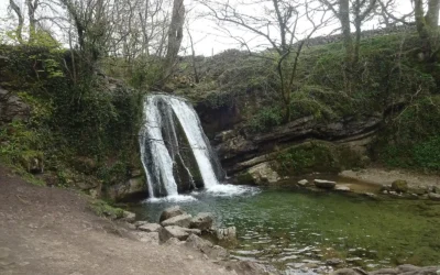
Janet’s Foss
Janet's Foss: The Fairy Queen's Waterfall in the Yorkshire Dales There is a moment, walking through the woodland on the path from Malham, when the trees close in, the sound of water rises, and a small but perfectly formed waterfall appears in a mossy dell ahead of you...
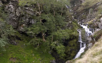
Cautley Spout
Cautley Spout: England's Highest Cascade Waterfall You are walking a level path through a broad, treeless valley when the Howgill Fells suddenly drop away on your left, and there — streaming down the whole face of the cliff — is Cautley Spout. Not a single...
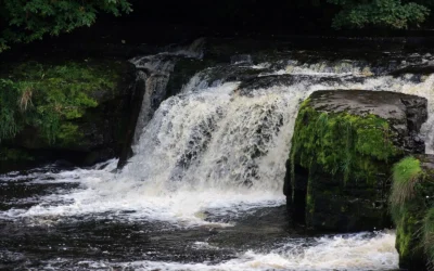
Aysgarth Falls
Aysgarth Falls: Wensleydale's Three-Stage Waterfall You hear them before you see them. Walking down through Freeholders' Wood, the sound of the River Ure builds steadily until you round a bend and the whole river spreads itself across a series of broad...
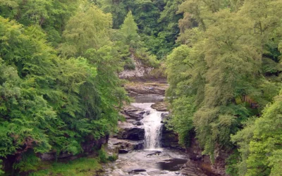
Falls of Clyde
Falls of Clyde: Scotland's Four Waterfalls on the River Clyde Stand at the Corra Linn viewpoint after heavy rain and the whole River Clyde seems to gather itself and throw itself over the edge — twenty-six metres of white water crashing into a wooded gorge, the...
Grey Mare’s Tail
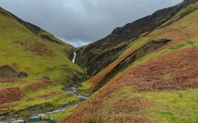
Grey Mare's Tail: The 60-Metre Cascade That Hides a Secret Loch Above It Most people who pull into the car park below Grey Mare's Tail come for the waterfall — a tall, thin ribbon of white water dropping 60 metres down a craggy cliff into the Moffat Water valley. And...