
Eas a’ Chual Aluinn
Eas a' Chual Aluinn: Britain's Highest Waterfall
Imagine standing at the lip of a high, windswept plateau as a ribbon of water peels away beneath your feet and falls — and falls — for some 200 metres into the wild glen below. This is Eas a' Chual Aluinn, widely regarded as the tallest waterfall in the United Kingdom, hidden deep in the rugged emptiness of Assynt in Sutherland.
It is more than three times the height of Niagara Falls, yet hardly anyone sees it, because there are no shortcuts here. You reach it either by a long, boggy mountain hike to a viewpoint at the top, or by taking to the water and admiring it from below. Either way, this is a waterfall you have to work for.
Here's everything you need to know before you go.
About Eas a' Chual Aluinn
Eas a' Chual Aluinn drops around 200 metres (about 650 feet), which makes it, by most reckonings, the highest waterfall in Britain — taller than the better-known Steall and Falls of Glomach, and more than three times the height of Niagara. Rather than a single column, the water descends in two great steps down dark, ancient Lewisian gneiss cliffs — some of the oldest rock anywhere in Britain — before gathering in the glen and emptying into Loch Beag and Loch Glencoul, a sea loch reaching inland from Kylesku.
One honest word of warning: the flow is highly seasonal. After heavy rain it's a thundering white cascade, but in a dry summer it can dwindle to a thin trickle, and more than a few visitors have made the long walk only to find it disappointing. For the falls at their most dramatic, come a day or two after a good spell of rain.
The setting is pure Assynt — a sparse, glacier-carved wilderness of bare peaks and scattered lochans, with the falls tucked into a steep, lonely glen southeast of Kylesku.
Getting there
The falls can only be reached on foot, or viewed from below by boat, so "getting there" mostly means reaching the trailhead.
By car, the parking area sits at a sharp hairpin bend on the A894 between Kylesku and Lochinver, at the northern end of Loch na Gainmhich — about three miles south of Kylesku, or four kilometres south of Unapool. The grid reference NC281278 (postcode IV27 4HW covers the wider area) will get you close; coming from the Kylesku side, you'll pass the Wailing Widow Falls just before the bend.
Public transport is very limited out here. Buses serve Kylesku and Lochinver, but there's no easy onward link to the trailhead, so check the current timetables and plan carefully.
There's also a wonderful alternative to the hike: in good weather, seasonal boat trips run from the pier at Kylesku across Loch Glencoul, giving a superb view of the falls from below. Check the operators' current schedules, as sailings are weather-dependent.
If you're coming from further afield, public transport to the trailhead is very limited, so visitors arriving without a car often prefer to let a local driver handle the journey.
Compare Transfers & Local Transport in the North West Highlands →
Where does the name come from?
The name is an anglicised version of the Scottish Gaelic Eas a' Chùil Àlainn — "the waterfall of the beautiful tresses" — a lovely image of the long, flowing strands of water draping down the cliff. It's pronounced, very roughly, "es-a-kohl-a-loo-un," and some link the name instead to nearby Glencoul.
There's no famous legend attached to the falls themselves; here, the poetry is in the name and in the sheer, lonely grandeur of the place.
The walk and the trails
From the hairpin-bend car park, the route follows an old track around the northern end of Loch na Gainmhich. Early on you reach the Wailing Widow Falls, where you cross the outflow on stepping stones — these can become impassable after very wet weather, in which case a second path loops around the south side of the loch. Beyond, the way crosses open, boggy moorland to a vantage point near the top of the falls.
Three things are worth knowing before you set out, because this walk catches people out.
First, the path is not signposted and frequently vanishes into deep bog, so an Ordnance Survey map (Explorer 442) and a compass — and the skill to use them — are essential. Phone signal is non-existent.
Second, there's a companion waterfall, Eas-an-t-Sruth Ghil, on the opposite side of the valley that is easily mistaken for the main falls; many walkers turn back at it, never seeing the real thing. To reach Eas a' Chual Aluinn you need to cross the final stream.
Third, because the cliff is so high and so sheer, you only get a partial, foreshortened glimpse from the top — and the edge is genuinely lethal. Never go right to the lip of the plateau or try to climb beneath the falls. The full sweep of the drop is best appreciated from below, on the boat.
Parking
There's a small parking area at the sharp hairpin bend on the A894, at the northern end of Loch na Gainmhich (grid reference NC281278, around three miles south of Kylesku). It holds only a handful of cars, with a rougher overflow space just to the south if it's full, and it's roughly 300 metres from there to the start of the path. No parking charge is signed, but it's worth checking on-site. Spaces go quickly in summer, so arrive early.
Facilities
Make no mistake: this is genuine wilderness. There are no toilets, no café and no shops at the falls or anywhere along the walk, and no mobile signal once you leave the road. You must set out completely self-sufficient.
The nearest facilities are along the coast — Kylesku, and the larger villages of Lochinver and Ullapool, have shops and somewhere to eat. Fuel stations are sparse in this corner of the Highlands, so top up in Ullapool or Lairg, and fill your water bottles before you start walking.
Things to know before you go
Best time to visit. Aim for late spring to early autumn for the most settled weather and longest daylight, but remember the flow is seasonal — the falls are far more impressive after rain, and can be a mere trickle in a dry spell. Spring snowmelt brings fuller water, while April often means quieter roads and fewer midges.
Midges. On still, damp summer days the Highland midges can be relentless, so pack repellent and a head net.
Dogs. Dogs should be on a lead for the livestock and the cliff edges — but think hard about whether yours can handle a rough six-mile bog walk.
Accessibility. This is not an accessible site in any sense: it's a long, rough, trackless mountain walk over wet ground, unsuitable for wheelchairs or pushchairs.
Navigation and safety. This matters more here than at almost any waterfall in Britain. Carry an OS map and compass (there's no phone signal), tell someone your plans and expected return, and avoid the walk in mist or low cloud, when it's dangerously easy to lose the path. Keep well back from the plateau edge, never attempt to descend beneath the falls, and treat winter as a full mountaineering outing needing the right kit and skills. It's no place for young children or first-time hillwalkers.
Swimming. No — this is a remote, cold and dangerous glen with sheer drops, not a bathing spot. Enjoy it from a safe distance.
Where to stay
Because the falls are so isolated, a comfortable coastal base and an early start make all the difference.
The harbour village of Lochinver, around twenty miles to the south, is the nearest place with a decent range of accommodation, plus shops and a famous little pie shop to fuel up at.
For a wider choice and the best transport links, the busy port town of Ullapool, further south down the coast, is the main hub of the north-west and an excellent base for exploring Assynt and the North Coast 500.
Find Hotels & Stays in Ullapool →
What to pack
This is a serious wilderness hike, so pack properly — your safety can depend on it.
- A pair of waterproof walking boots, as the peat-hag ground is wet and muddy even in summer.
- A waterproof jacket and trousers and warm layers; the weather turns fast.
- A reliable compass — the path is unmarked and there's no phone signal.
- A set of walking poles for the rough, boggy and uneven going.
Add an OS Explorer 442 map, a midge net, a power bank, plenty of water and high-energy snacks, and a first-aid kit, and you'll be well set.
Nearby attractions and making a day of it
Assynt is one of the most spectacular corners of Scotland, and this waterfall sits right on the North Coast 500, surrounded by dramatic peaks and an iconic bridge.
| Attraction | Why Visit | Distance |
|---|---|---|
| Wailing Widow Falls | A short, atmospheric detour right beside the car park, tied to a sad local tale of grief | Beside the car park |
| Kylesku Bridge | The elegant curved bridge that is one of the most photographed structures on the NC500 | ~5 minutes north |
| Ardvreck Castle | The romantic ruin of a 15th-century stronghold on a promontory in Loch Assynt | ~15 minutes south |
| Quinag | One of Assynt's most dramatic mountains, a multi-peaked massif dominating the skyline, with superb hillwalking | Dominates the skyline |
| Suilven & Stac Pollaidh | Two of Scotland's most distinctive peaks, rising abruptly from the moorland further south towards Lochinver | To the south |
For a full day, pair the falls with the short Wailing Widow Falls walk and a stop at Kylesku Bridge, then drive south to Ardvreck Castle on Loch Assynt.
Browse North West Highlands & NC500 Tours →
Photography tips
Eas a' Chual Aluinn is a tricky but rewarding subject. From the top you can capture only part of the falls, framed by the plateau and the glen — and you must do it from a safe distance back from the edge. For the full height, the boat trip on Loch Glencoul gives the classic view from below.
Visit after rain for the strongest flow and the moodiest atmosphere, aim for the soft light of early morning or late afternoon, and bring a tripod for long exposures and a waterproof cover for the ever-present spray and Highland drizzle. Above all, never put yourself near the edge for a shot — no photograph is worth it.
Conclusion
Eas a' Chual Aluinn is the kind of place that rewards the determined and humbles everyone. The tallest waterfall in Britain, it hides itself away in the ancient wilderness of Assynt, asking you to either earn it across miles of bog or come at it sideways from the water — and even then, only ever showing you part of itself from the top. Time your visit for after the rain, go properly prepared, and this elusive Highland giant will repay every step.
FAQs
How tall is Eas a' Chual Aluinn?
It drops around 200 metres (about 650 feet), making it widely regarded as the tallest waterfall in the United Kingdom — more than three times the height of Niagara Falls. The water descends in two main steps rather than one single plunge.
Is there a fee to visit Eas a' Chual Aluinn?
No — the falls are free to visit. The seasonal boat trips from Kylesku that show the falls from below are run by private operators and charged separately, so check their current details.
What is the best time to visit Eas a' Chual Aluinn?
Late spring to early autumn offers the most settled weather, but the flow is seasonal and the falls are far more dramatic after heavy rain — in a dry summer they can be little more than a trickle.
Are dogs allowed at Eas a' Chual Aluinn?
Yes, on a lead for the livestock and the dangerous cliff edges — but bear in mind it's a long, rough bog walk, so consider whether your dog can manage it.
Is Eas a' Chual Aluinn accessible for wheelchairs?
No. It's a long, rough, trackless mountain walk over boggy ground, and is not suitable for wheelchairs or pushchairs.
What are the parking options at Eas a' Chual Aluinn?
There's a small parking area at the sharp hairpin bend on the A894 (grid reference NC281278), with a rougher overflow space just to the south. It fills quickly in summer, so arrive early.
Can I swim at Eas a' Chual Aluinn?
No — it's a remote, cold and dangerous glen with sheer drops, not a place for swimming. Admire it from a safe distance.
What should I wear when visiting Eas a' Chual Aluinn?
Sturdy waterproof boots, a waterproof jacket and trousers and warm layers, and carry an OS Explorer 442 map and a compass, as the path is unmarked and there's no mobile signal.
Are there guided tours, or a way to see it without the hike?
Yes — in good weather, seasonal boat trips from Kylesku sail across Loch Glencoul for a view of the falls from below, ideal if the long hike doesn't appeal. Some local operators also offer guided walks.
How hard is the hike to Eas a' Chual Aluinn?
It's about six miles (10 km) there and back, taking four to five hours over rough, boggy and unsignposted ground. It's best suited to experienced hillwalkers comfortable with map and compass.
What's nearby?
The Wailing Widow Falls and Kylesku Bridge are right on the doorstep, with the Assynt peaks of Quinag, Suilven and Stac Pollaidh, the ruin of Ardvreck Castle, and the village of Lochinver all within reach.
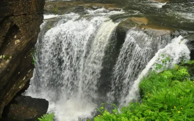
Aberdulais Falls
Aberdulais Falls: Where Wales' Industrial Story Began In the winter of 1584, a German engineer named Ulrich Frosse chose this gorge for a secret reason: the River Dulais plunging over its ridge of hard Pennant sandstone was exactly the power source he needed. Under...
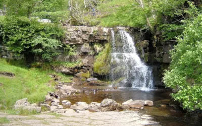
East Gill Force
East Gill Force: Where Two Great Walks Meet There is a particular pleasure in arriving at East Gill Force. You have walked the short path from Keld, crossed the long stone footbridge over the River Swale, and then the path turns and the waterfall is simply there — the...
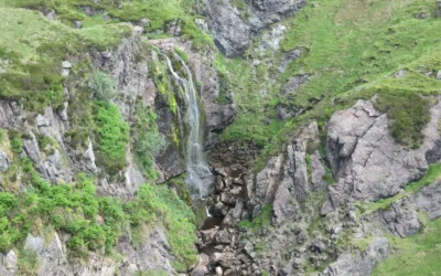
Spout of Garnock
Spout of Garnock: Ayrshire's Highest Waterfall The River Garnock rises on the southern slopes of the Hill of Stake, the highest summit in Clyde Muirshiel Regional Park, and barely has time to become a river before it falls off the edge of the moorland. About a mile...
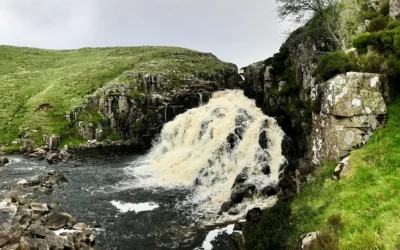
Cauldron Snout
Cauldron Snout: England's Longest Waterfall Most waterfalls announce themselves with a sudden vertical drop. Cauldron Snout does something different: it unrolls. From below, the River Tees is white and relentless for two hundred yards, cascading down the black...
Falls of Foyers
Falls of Foyers: The Smoking Falls of Loch Ness When Robert Burns reached the Falls of Foyers in 1787 and looked down into the gorge, he saw what he described as "the horrid cauldron" — the deep, spray-filled amphitheatre at the base of the lower falls,...